


BILLINGS — First, a note: A very strong geomagnetic storm reached our atmosphere Monday afternoon (On a scale of 1-5, this is a 4). There is the possibility of Northern Lights Monday evening. Get away from city lights, and keep in mind they often are more visible to your camera than the human eye.
Now, let's talk some weather. Beginning Monday night, powerful winds will roar through the western foothills with gusts potentially reaching 40-65 mph. Winds will persist into Tuesday, with the strongest gusts expected from Livingston to Big Timber and near Harlowton, where winds could exceed 60 mph.
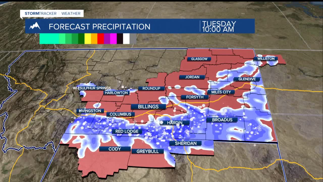
Tuesday brings the first cold front sweeping across the region, generating widespread gusts of 30-50 mph well across the eastern plains. This system packs enough moisture for brief snow showers, particularly east of Billings, where blowing snow could create hazardous travel conditions.
The Pryor and northern Bighorn mountains will see the heaviest snowfall, with several inches expected. The Interstate 90 corridor between Hardin and Sheridan bears watching, as the combination of snow and strong winds could create dangerous driving conditions.
Wednesday delivers a second fast-moving cold front, bringing another round of gusty winds ranging from 30-50 mph across the region. But the snow potential is lean outside the mountains.
By Thursday and Friday, a cold high-pressure system settles over the western Dakotas. Temperatures will plummet with single-digit highs Thursday around Miles City and Baker. Light snow flurries remain possible but aren't expected to accumulate significantly.
This arctic blast appears short-lived. A warming trend begins over the weekend, with temperatures climbing back into the 30s and 40s by Sunday, though gusty foothills winds may make a comeback.
