


BILLINGS — Another wave will bring more snow and continue the colder temperatures on Tuesday. Winter Weather Advisories remain in effect for southern Big Horn and the Sheridan Foothills (1–4 inches) and the northeast Bighorn Mountains (4–8 inches) through Wednesday morning. Light snow is possible in the lower elevations, while Red Lodge and Cody could pick up a couple of inches. Some locations may see rain during the afternoon. Daytime highs will be in the mid-30s to low 40s.
Cooler air will retreat to the north midweek, allowing for a brief two-day warm-up, with highs in the upper 40s to low 50s Wednesday, then mid-50s to low 60s Thursday.
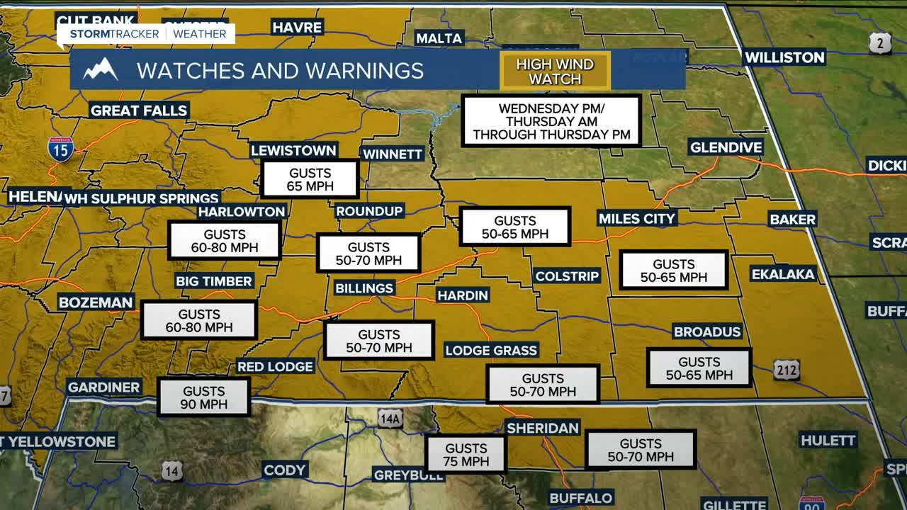
Winds will increase Wednesday across the western foothills, especially in gap-prone areas, ahead of our next winter system. By Thursday morning, winds are expected to gust between 50–70 mph across the region, with gusts between 60–80 mph across the western foothills, and up to 90 mph in the Absarokas, Beartooths, and Crazies. Be prepared if you plan to travel during that period, especially if you drive a high-profile vehicle like a big rig, box truck, or will be pulling a trailer.
A big push of Pacific moisture is forecast to sweep in on Thursday as a cold front moves through, bringing a good chance of precipitation, which could help alleviate some of the fire threat due to the gusty winds.
Daily rain and snow chances remain very good from Friday through the weekend as temperatures cool, with anywhere from a half to one inch of moisture potentially falling. Several inches of snowfall could be included across central and western zones, but that is less likely in southeast Montana for now. There remains quite a bit of uncertainty with this, though. Be sure to keep informed on the forecast if you have any travel or outdoor plans beyond Thursday.
Miller Robson
Q2 Morning Meteorologist
miller.robson@ktvq.com
