


BILLINGS — Winter Storm Warnings and Winter Weather Advisories remain in effect mainly through the morning, with generally another 4–10 inches in the mountains and 1–3 inches in the foothills possible. Gusts between 30–40 mph are expected, so watch out for slick roads and reduced visibility if you plan to travel in these areas.
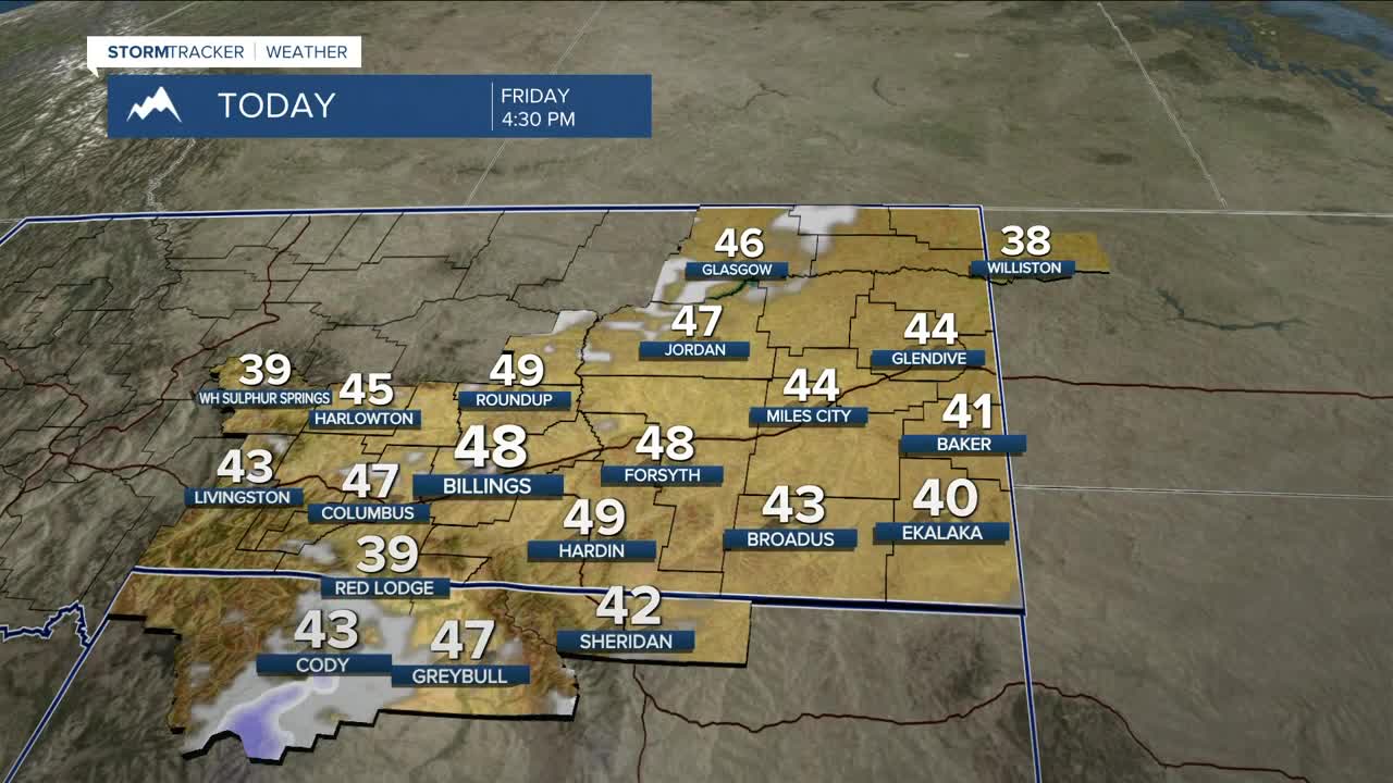
After temperatures in the 40s and 50s on Friday, high pressure will bring dry conditions and warmer temperatures across the weekend, with highs in the 50s and low 60s on Saturday, then mid to upper 60s on Sunday. Some locations could reach 70 degrees, and records could be challenged.
Winds will increase across the weekend with gusts between 30–40 mph region-wide and gusts between 60–75 mph from Livingston to Big Timber to Harlowton, especially Sunday into early Monday. Be prepared for hazardous crosswinds along I-90 and US-191.
With the strong winds, warmer temperatures, and low humidity, elevated fire weather conditions may come into play, depending on how much precipitation the area receives from this latest system.
Confidence is growing that another system will bring a chance of more mountain snow and cooler temperatures during the first half of next week. If the air gets cold enough, some accumulating snow will be possible in the lower elevations, but there is still quite a bit of uncertainty with this. Be sure to monitor the forecast if you plan to travel during that period.
Miller Robson
Q2 Morning Meteorologist
miller.robson@ktvq.com
