


BILLINGS — Light rain showers are expected Tuesday night and Wednesday, followed by more warm November weather through the weekend. However, a significant weather shift is coming next week that could bring winter cold just in time to complicate Thanksgiving travel.
Tuesday night & Wednesday: Scattered light showers across the region, with eastern areas possibly seeing up to 0.20 of an inch of rain.
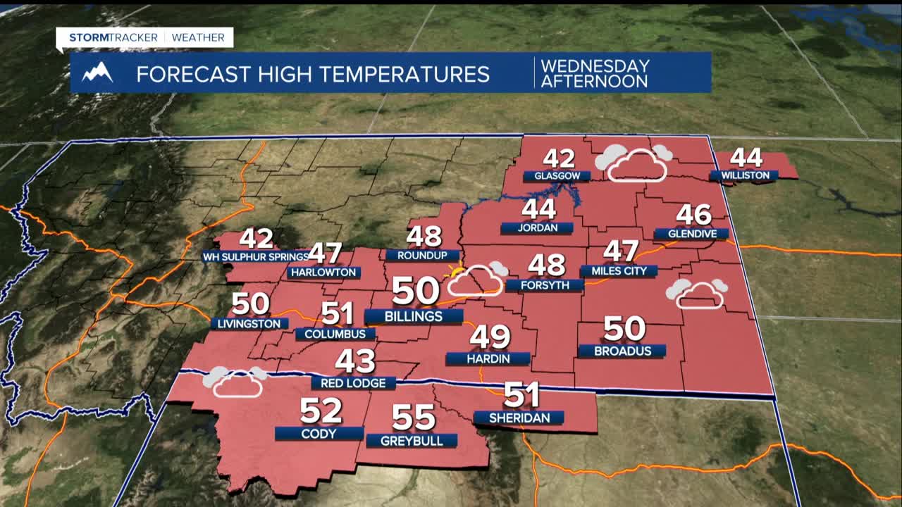
Wednesday: A brief chance of wet snow mixing in at higher elevations like Judith Gap and Red Lodge, but any accumulation unlikely.
Rest of the week: Dry and warm, with temperatures climbing into the 50s and near 60° in some places.
Weekend Outlook:
Overall, continued above-normal temperatures will start in the upper 20s to upper 30s then peak in mainly the 50s through Monday. Breezy conditions developing along western foothills support drier and warmer days.
A major weather pattern change arrives Monday night/Tuesday. This will bring much colder temperatures and our first real chance of snow this season.
While colder days with the highs in the 30s seem the most likely, there could be potential travel disruptions for Thanksgiving week and holiday weekend if the possibility of snow increases. Keep checking back!
