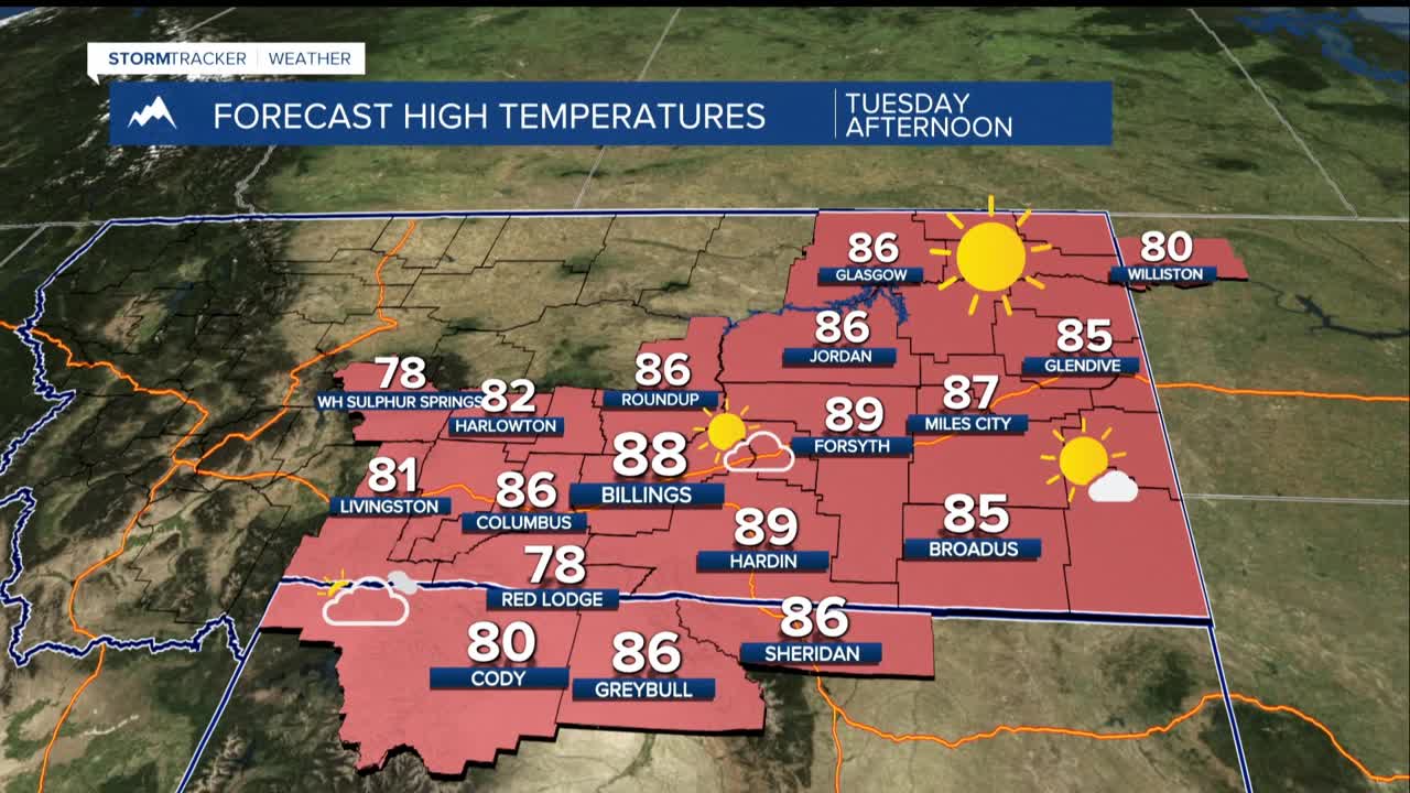


BILLINGS — A ridge of high pressure aloft builds over the area through midweek. That will keep temperatures above the normal upper 70s to 80s for this time of year.
The ridge will become “dirtier”, meaning more clouds with increasing moisture, while smoke remains a factor this week. Plan for reduced air quality at times. If you’re sensitive to smoke, monitor air quality forecasts.
Pacific moisture flowing over the ridge will moisten the air from above in the coming days, leading to high-based showers and thunderstorms mainly in the afternoons and evenings. Some activity may linger overnight but expect it to be light overall. Gusty 30–45 mph winds will be the main threat, with occasional lightning.
As the amount of moisture in the air increases and the available lift in the atmosphere increases, the risk of stronger storms producing heavy rain increases by Wednesday afternoon. Highs will be the warmest Tuesday and Wednesday, reaching the upper 70s to low 90s.
Thursday through Saturday is the wetter stretch of days. The ridge shifts east as a strong Pacific system moves into the Pacific Northwest. This creates increasingly cooler air aloft, and greater instability.
Expect increasing precipitation chances across the area Thursday through Saturday, with cooler temperatures reaching mainly the 70s. Some places will stay in the 60s for highs Saturday.
Sunday through Monday, as the upper low opens up and lifts north, precipitation potential will reduce but keeping some residual showers possible. Expect a relatively cool stretch of days with the highs mainly the 70s.
