BILLINGS — The wind remains strong around Livingston and Nye, where gusts could hit 45 to 60 mph through tonight. Mountain areas along the Beartooth front could see even stronger gusts up to 65 mph.
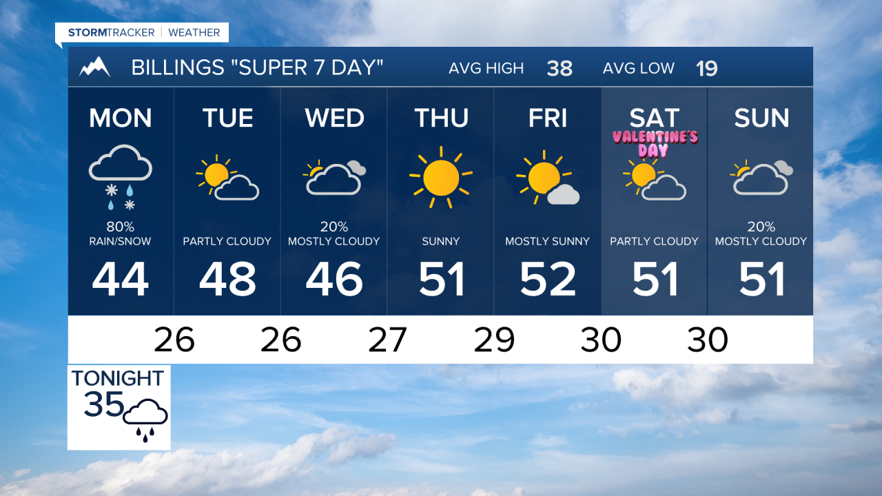
A weather system is moving in this evening that will flip the script. What starts as strong winds will transition into our first chance of rain and snow for quite a while.
For lower elevations, expect rain to begin this evening, then change to wet snow Monday morning as colder air moves in behind the cold front. The Monday morning commute could be tricky, especially north and east of Billings in areas like Wheatland (Harlowton), Golden Valley (Ryegate), and Musselshell (Roundup) Counties, where 1 to 2 inches of wet snow could accumulate on roads.
The Absaroka-Beartooth and Crazy Mountains are looking at 8 to 12 inches of heavy snow, with some peaks potentially seeing even more. The Bighorn and Pryor Mountains will see lighter amounts of 1 to 4 inches, but it's still enough to impact travel conditions.
Precipitation starts Sunday evening and continues through Monday morning before tapering off Monday afternoon. Some isolated snow showers could linger into Monday evening across the plains.
As this system moves through, expect a pattern change. High temperatures will drop into the 40s and lower 50s for the workweek with lows in the 20s and low 30s. That's a noticeable cool down from recent conditions. Wednesday brings another chance for mountain snow, but lower elevations should only see scattered showers.


