


BILLINGS — With a good amount of moisture and instability in the atmosphere, showers and thunderstorms are developing, particularly over the mountains. Some of these storms will become strong or severe, bringing large hail, strong winds, and heavy rain.
The right ingredients are there for funnel clouds or tornadoes to develop across southern Montana, but that is far less likely than hail and wind damage.
On a scale of 0 to 5, The Storm Prediction Center has indicated a 2 for potential severe weather from just north of Billings from Harlowton, north to Glasgow and east into the Dakotas for this afternoon and evening.
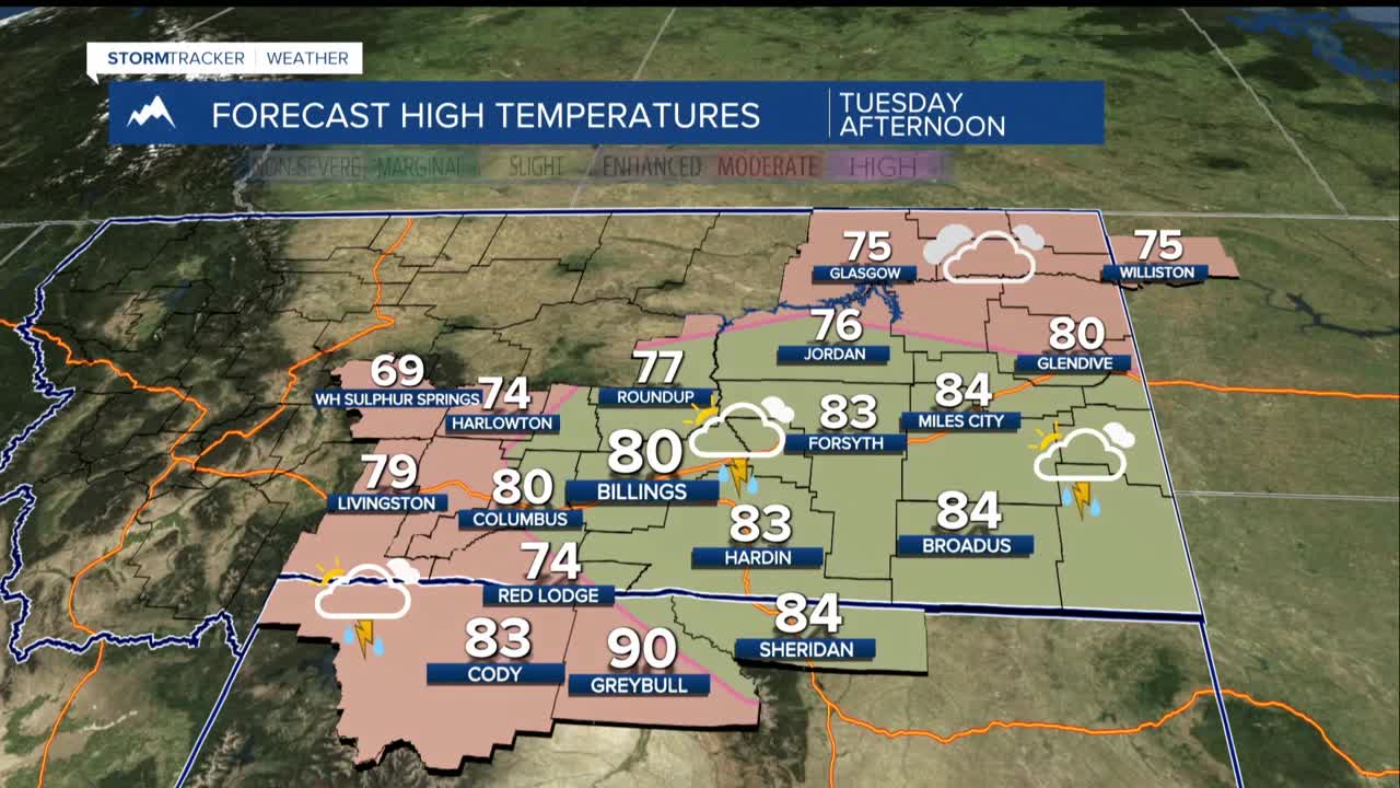
Tuesday, temperatures will cool down to the 70s and 80s. A cold front will bring more chances for showers and thunderstorms in the afternoon and evening, continuing into the night.
Some storms may become severe Tuesday afternoon and evening, with risks of large hail, strong winds, and heavy rain especially from Billings eastward. The severe risk is lower than Monday.
From Wednesday to Sunday, an upper-level weather pattern will keep showers and thunderstorms in the forecast. Scattered storms will likely continue throughout Wednesday, with heavy rain being a concern.
By Thursday, drier air will filter in, leading to warmer and drier conditions. Isolated showers and thunderstorms may still occur over the weekend as temperatures increase, reaching the 80s to mid-90s.
