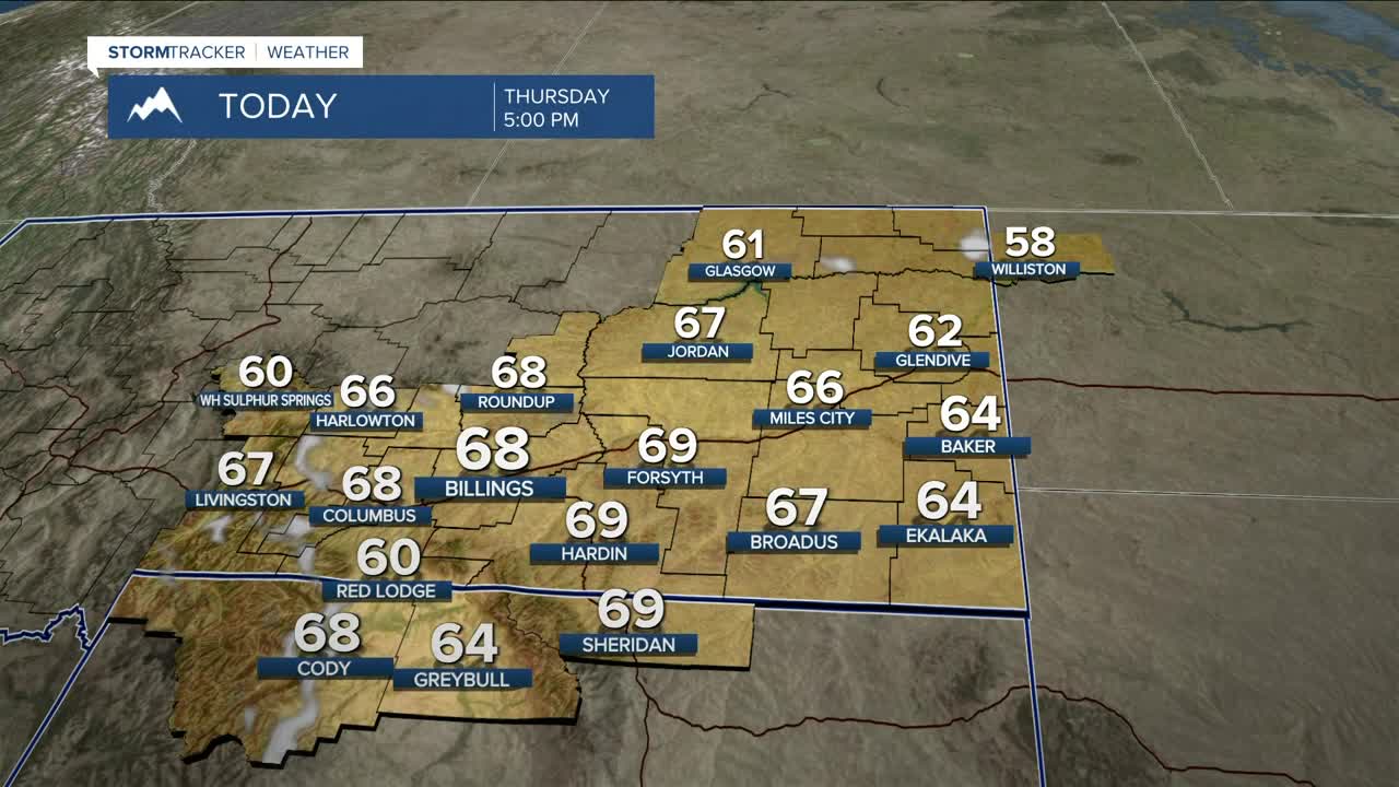


BILLINGS — High pressure will keep dry conditions in place through early Friday. It will also help warm daytime highs about 10–20 degrees above average for this time of year, with temperatures in the upper 50s to low 70s. A few locations including Billings and Miles City will have a chance to push near-record warmth on Thursday and possibly Friday.
A weak front is forecast to sweep through Friday. Gap-flow winds will increase ahead of it in the Livingston and Nye areas Thursday evening through Friday evening, with gusts between 55–65 mph possible, while gusts between 45–55 mph will be possible from Big Timber to Harlowton on Friday. It will be quite breezy elsewhere.
Most of the moisture from the front will stay in the mountains through early Friday afternoon, then slide out onto the plains Friday evening into the overnight hours. The higher peaks of the Beartooths and Absarokas could pick up 2–4 inches of snow, while the plains will see light rain, mainly under a tenth of an inch. High pressure will briefly bring dry conditions back into the area Saturday afternoon into early Sunday.
The front will also bring cooler temperatures across the weekend, but they will still remain above average in the 50s and 60s.
There is potential for a stronger system to begin moving in on Sunday, but models are still trying to get a handle on it with much variation still in place. While there is some agreement that a low will move in from the southwest, the impact is still in doubt. If the stars align just right, the mountains could receive a hefty amount of snow early next week. Lower elevations could also see some accumulation. Stay tuned.
Models still agree that temperatures will be cooler early next week, with near-seasonal highs in the mid to upper 40s on Monday before dipping into the upper 30s to low 40s on Tuesday and Wednesday.
Nighttime lows will be in the upper 30s east to upper 40s west on Thursday night, mid-30s to low 40s on Friday night, low to mid-30s across the weekend, then mid- to upper-20s early next week.
Miller Robson
Q2 Morning Meteorologist
miller.robson@ktvq.com
