


BILLINGS — Isolated showers and thunderstorms remain possible Monday afternoon into the evening. Otherwise, skies will be mainly sunny as daytime highs reach the upper 80s to low 90s.
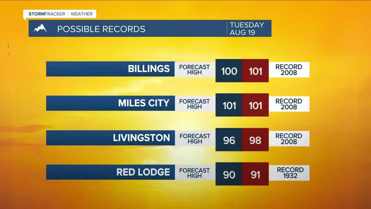
Strengthening high pressure will keep Tuesday and Wednesday mostly dry, with a few hit-or-miss storms possible each day, with a slightly better chance on Wednesday. Some locations could reach record daytime temperatures, with highs cracking 100 degrees. A Heat Advisory will be in effect for all of northeast Montana. This may extend to more of the area, though. Be sure to utilize ways to beat the heat. This period of hot and dry conditions will elevate the risk of wildfires. Don’t cause a spark!
A dry cold front is forecast to sweep through late Wednesday evening, bringing cooler temperatures to the area starting Thursday, with highs in the 80s. Temperatures will fall further into the upper 70s to lower 80s on Friday and Saturday, with a few isolated showers and thunderstorms possible. Daytime highs could return to the mid-80s in some locations on Sunday.
Nighttime lows will be mainly in the 50s and 60s through the weekend, but a few low 70s are possible Tuesday night.
Miller Robson
Q2 Morning Meteorologist
miller.robson@ktvq.com
