


BILLINGS — Expect warm and dry weather on Wednesday as a shortwave ridge moves through. Winds ease across eastern Montana but increase again over the foothills west of Billings, with westerly gusts of 20–40 mph. Elevated grass fire danger continues for much of south-central Montana, so don’t cause a spark. Highs will be mainly in the 50s and 60s (some 40s east), and many locations could see record highs, including Billings, Miles City, Red Lodge, and Sheridan.
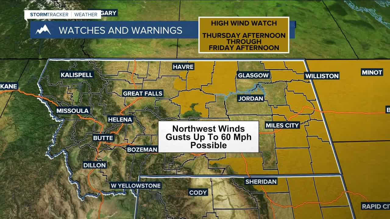
Two cold fronts bring another round of windy weather Thursday and Friday, with gusts between 30–40 mph across western and central areas, while gusts between 50–60 mph will be possible in far eastern Montana and northern Wyoming. It will stay mostly dry, but a slight chance of light snow could briefly reduce visibility due to blowing snow in our eastern counties Thursday evening into Friday. Billings may even see a few flurries Thursday afternoon if it gets cold enough behind the cold front. Temperatures are expected to drop during the day.
Friday will be cooler before warmer temperatures return for the weekend. A backdoor front Sunday may bring renewed wind and light precipitation to eastern Montana and northern Wyoming. Early next week stays mostly northwest flow, with a potential shift toward colder, snowier weather later—confidence remains low.
Miller Robson
Q2 Morning Meteorologist
miller.robson@ktvq.com
