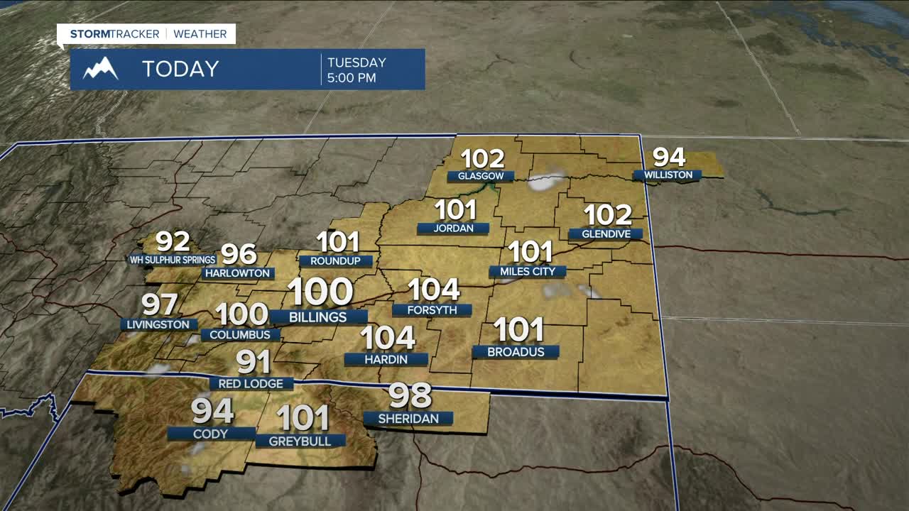


BILLINGS — The heat really kicks in on Tuesday, with record daytime temperatures possible (including Billings) as highs push into the mid-90s to low 100s under sunny skies. Take the necessary precautions to beat the heat. The best defense is to stay indoors as much as possible. Fire weather concerns will also be heightened, so don't cause a spark!
Wednesday could be another record-breaking day, with highs once again in the mid-90s to low 100s as high pressure keeps mainly dry and hot conditions in place. Fire weather concerns also remain. A few isolated storms could pop up during the afternoon and evening hours.
Afternoon showers and thunderstorms are possible on Wednesday ahead of a cold front that is forecast to pass through by early Thursday morning, bringing a welcome cooldown with highs mainly in the mid-80s on Thursday.
A backdoor behind the initial front should bring a reinforcing shot of cooler air, dropping daytime highs into the upper 70s to mid-80s on Friday and Saturday before temperatures warm back into the mid to upper 80s on Sunday. A few isolated showers and thunderstorms are possible across the weekend.
Nighttime lows will be mainly in the 50s and 60s through early next week, although some locations may see lows in the 70s on Tuesday night.
Miller Robson
Q2 Morning Meteorologist
miller.robson@ktvq.com
