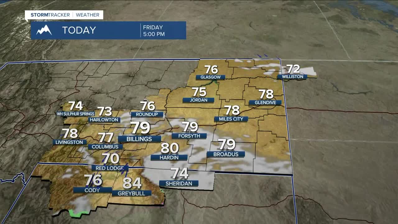


BILLINGS — After a nice cooldown on Thursday, a reinforcing shot of cooler air from Canada will knock daytime highs down into the mid-70s to around 80° on Friday under mostly sunny to partly cloudy skies. There could be just enough energy to bring a low chance of showers and perhaps a thunderstorm across the Bighorns, Sheridan County, WY, and surrounding areas in the morning and early afternoon.
It will be slightly warmer across a beautiful weekend with highs in the mid-70s to low 80s to go along with a healthy dose of sunshine. Skies could be hazy at times due to smoke from western Montana wildfires, but minimal surface impacts are expected. Still, if you have a sensitivity to smoke, check the air quality before stepping outside.
Next week is shaping up to be rather quiet as high pressure and northwest flow will bring near-seasonal daytime highs (low to mid-80s) and nighttime lows (40s and 50s) along with mainly dry conditions with low chances of daily showers and thunderstorms. A weak shortwave may bring a slightly better chance of rain by the middle of the week.
Miller Robson
Q2 Morning Meteorologist
miller.robson@ktvq.com
