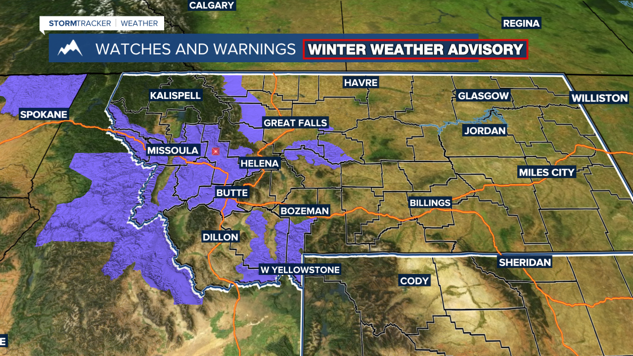
BILLINGS — An upper trough moving in will bring lower-elevation rain and mountain snow through Sunday evening. A few Saturday evening thunderstorms over south-central Montana spreading into the plains could produce gusty winds, heavy rain, and small hail, with the heaviest activity focused in western and central areas. Overnight, rainfall will become steadier as a cold front moves through.
By Sunday, the system shifts northeast, and strong northwest winds will develop across the plains, gusting 25–50 mph. Colder air will settle in, keeping highs in the 40s and 50s Sunday through early next week, with lingering mountain and foothill snow and widespread frost or freeze conditions expected Sunday night. Low clouds and a few flurries may persist into early Monday, followed by clearing and another cold night.
By Sunday night, rain totals around a half inch are expected for much of south-central Montana. Snow levels are expected to lower close to the valley floors across the region, bringing forecast snowfall totals of 5 to 10 inches over the Absaroka-Beartooth and Crazy Mountains, and 2 to 5 inches over the Bighorn Mountains, mainly above 9,000 feet. In the Q2 viewing area, the Little Belt and Highwood Mountains will be under a Winter Weather Advisory from midnight Saturday night to noon Monday.
Cool and unsettled conditions will persist through the week as another large low-pressure system moves in from the West Coast Tuesday into midweek. While the exact track remains uncertain, temperatures will generally stay in the upper 40s to low 60s, with increasing chances of rain and mountain snow by midweek. Forecast details may change as the system’s path becomes clearer.
Miller Robson
Q2 Morning Meteorologist
miller.robson@ktvq.com


