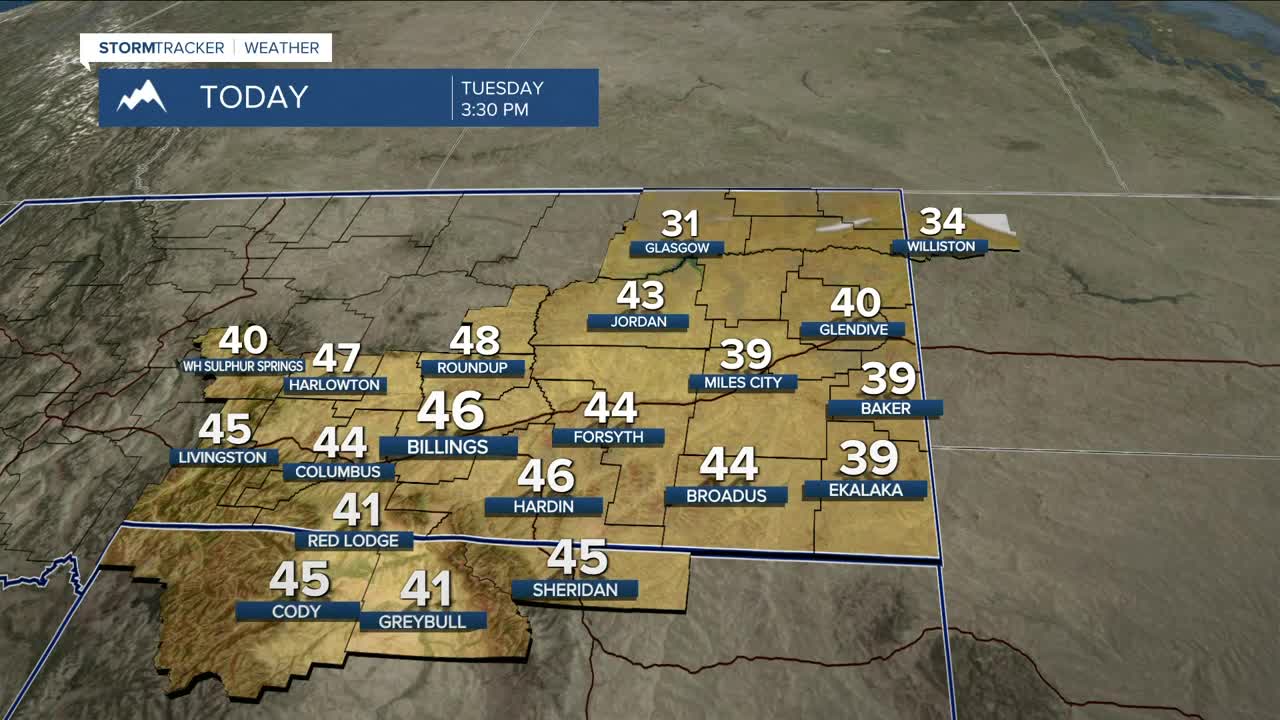


BILLINGS — Northwest flow pattern remains locked in as the region is sandwiched between a stubborn trough to our east and high pressure to our west. This is keeping a steady downslope west wind in place, driving well above-normal temperatures and dry weather for most lower elevations.
There will be light snow Tuesday morning in some of our eastern counties, and a weak cold front dropping out of Canada will bring a low chance of snow Wednesday morning as well, along with a slight drop in temperatures in northeast Montana.
Winds will remain strong at times along the western foothills through Wednesday, with gusts between 40–55 mph. They could ease up a bit during the day before ramping back up again late Tuesday night into Wednesday, especially near Livingston along I-90, Big Timber, and Harlowton on US-191. A few isolated gusts near 60 mph are possible.
Looking ahead to late week, Pacific moisture will try to push into the region Friday and linger into the weekend, but widespread precipitation is not expected. Many locations won't see any moisture at all, while west-facing mountain slopes may pick up some light snow.
High temperatures through the period stay mild, ranging from the upper 40s to low 50s in the west, and the mid 30s to low 40s across the east.
Miller Robson
Q2 Morning Meteorologist
miller.robson@ktvq.com
