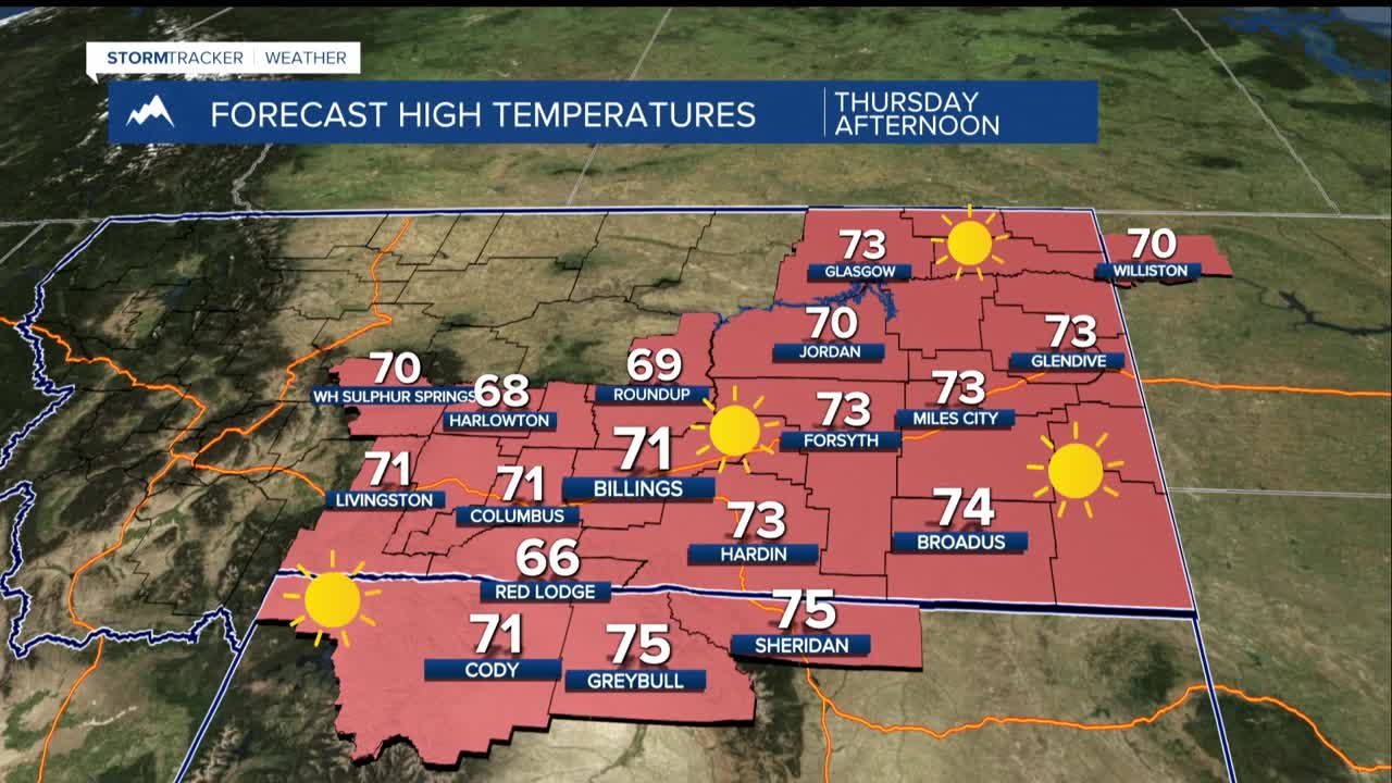


BILLINGS — Expect the pleasant streak of warm, dry weather to continue through the remainder of the work week. But significant changes loom as a developing weather system could bring notable precipitation by the end of the weekend.
Upper-level ridging will maintain its grip over the area through Friday, keeping high temperatures comfortably settled in the upper 60s and 70s while overnight lows dip into the 30s and 40s. Breezy conditions in the western foothills will punctuate the otherwise calm weather pattern. Livingston to Nye will bear the brunt of the strongest winds, where southwesterly gusts could reach 20 to 35 mph.
Saturday is a transition day as a weather system approaches from the west. There is significant uncertainty in the forecast details, but by Sunday there will be a change to cooler, wetter and windier conditions.
The most significant precipitation is expected to target the mountains and foothills of southwestern and central Montana, where there's a moderate chance of accumulating at least a quarter-inch of moisture.
The precipitation threat diminishes substantially, moving eastward across the Montana plains toward the Dakotas, dropping to just a 10 percent chance along the Montana-Dakota border.
Cooler air filtering into the region will drive snow levels down to around 6,000 feet by Sunday. Mountain snow is virtually certain with this system, though the likelihood of seeing six or more inches has decreased over the past day.
