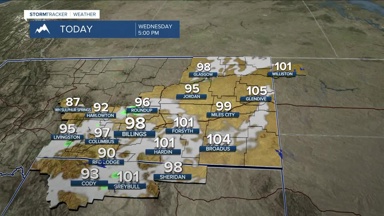


BILLINGS — Wednesday will be another hot and potentially record-breaking day, with highs ranging from the mid-90s to low 100s. A Heat Advisory remains in effect for parts of the area through the evening. The hot and dry weather raises the wildfire risk, so don’t cause a spark! Isolated showers and thunderstorms will develop late afternoon into the evening ahead of an approaching cold front. Areas north and northeast of Yellowstone County could see a strong to severe thunderstorm or two.
The cold front is expected to sweep through by early Thursday morning, bringing relief from the extreme heat, with highs mainly in the mid-80s. Even cooler air is expected to move in on Friday as a backdoor front drops into the area, lowering daytime highs into the 70s and 80s. These temperatures are expected to remain through early next week. Chances for precipitation over the weekend through the middle of next week remain very low.
Miller Robson
Q2 Morning Meteorologist
miller.robson@ktvq.com
