


BILLINGS — Northwest flow settles in, bringing a couple of waves of Pacific moisture with a 20–50% chance of rain and snow Wednesday morning before tapering off by the afternoon. Lower elevations and foothills pick up just a few tenths — mainly in south-central Montana — but slick roads are possible early thanks to cooler pavement temperatures.
On Thanksgiving Day, a bit of lingering upper energy and warmer air sliding in from the southeast could spark very isolated rain and snow showers. There is also a very low chance of freezing rain. Most areas won’t see any precipitation.
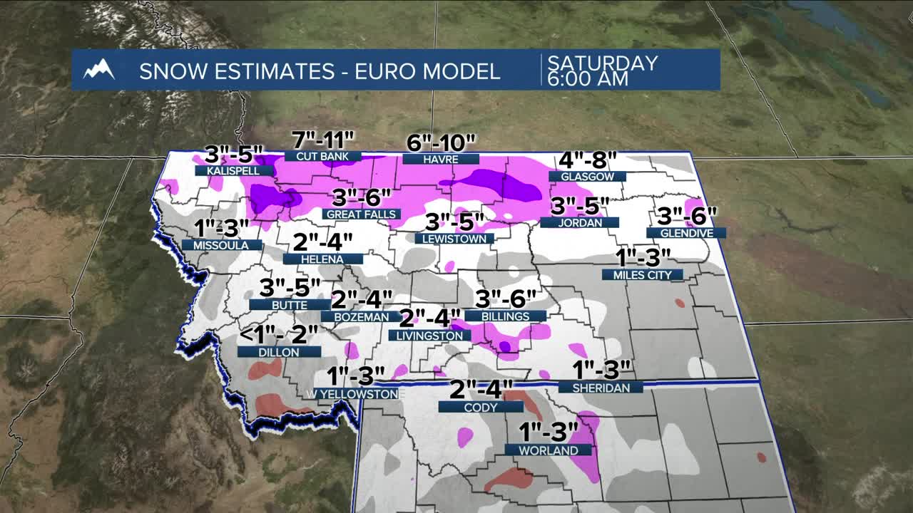
Friday brings a colder push from the north and our best chance for widespread measurable snow. Most of the accumulation comes Friday morning through Saturday morning. Expect 5–10 inches in the Beartooth/Absaroka and Crazy Mountains, 3–6 inches for the Bighorn and Pryor Ranges, and 2–5 inches across south-central Montana. Southeast Montana and north-central Wyoming look closer to 1–3 inches. Keep in mind, these are estimates and can absolutely change. North winds strengthen Friday into Friday night, creating reduced visibility at times.
In terms of actual moisture, some locations could receive up to a quarter of an inch while the mountains could pick up well over half an inch.
The weekend into Monday turns colder and drier with daytime highs dipping into the teens and 20s and nighttime lows in the single digits and teens, with a few spots possibly dipping below zero. There’s a 20–50% chance of subzero lows Sunday morning, mainly north. Models show temperatures easing a bit Monday and Tuesday with another system possible around Tuesday/Wednesday.
Travel impacts: Snow showers move west to east Wednesday with slick roads early, especially in the passes, before conditions improve during the afternoon. Thanksgiving brings a very low chance of spotty rain and snow later in the day with only minor impacts possible. The main system arrives Friday into Saturday morning with widespread snow — heavier in the mountains, lighter but still impactful in the lower elevations — along with breezy north winds and reduced visibility. The weekend turns sharply colder, with highs in the teens and 20s and subzero lows possible by Sunday morning, so watch out for slick spots.
Miller Robson
Q2 Morning Meteorologist
miller.robson@ktvq.com
