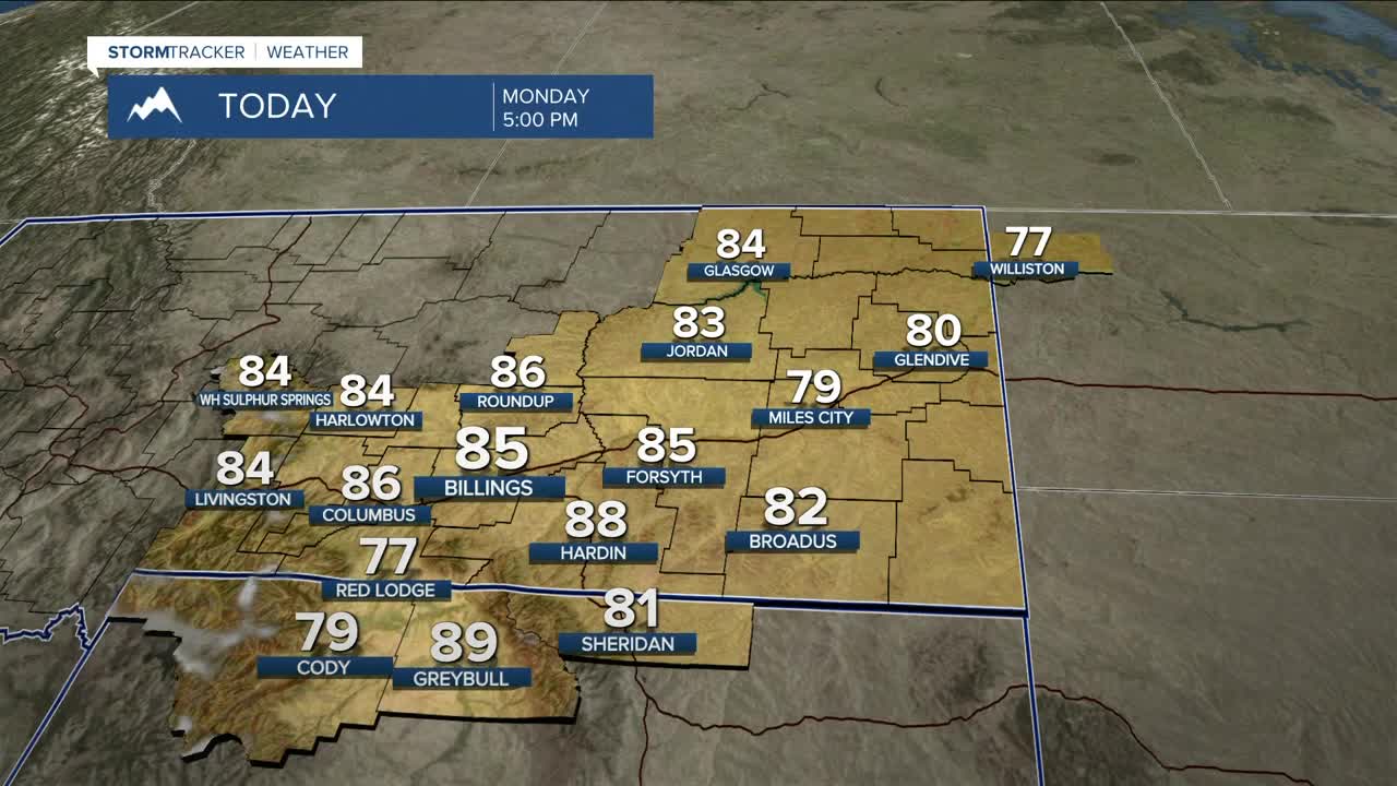


BILLINGS — Expect mainly dry and comfortable weather through the first half of the week, with highs in the upper 70s to mid-80s as northwesterly flow persists. Skies will be hazy from time to time, but much of the wildfire smoke should not reach the surface. It would still be wise to monitor air quality before heading outside if you are sensitive to smoke.
Some monsoonal moisture will begin to move in Monday evening and will bring a chance of rain and thunderstorms in our western mountains and foothills on Tuesday. A disturbance is forecast to move through by Wednesday evening, bringing a chance of more widely scattered precipitation on Thursday and Friday. Some of these storms could be slow-moving, increasing the risk of heavy rainfall that could pose problems for flood-prone areas and burn scars. These areas will need to keep a close watch.
High pressure is expected to bring a lower chance of rain across the weekend.
Daytime temperatures will remain near seasonal averages Wednesday through the weekend, with highs in the mid-70s to low to mid-80s.
Nighttime lows will be in the 40s and 50s Monday night, then mainly in the 50s and 60s through the rest of the week.
Miller Robson
Q2 Morning Meteorologist
miller.robson@ktvq.com
