


BILLINGS — A weather system will bring rain and mountain snow through Monday, with the best precipitation chances in the mountains and foothills. Temperatures will drop Monday into Tuesday morning, then rebound to warm 80s for the rest of the week under building high pressure.
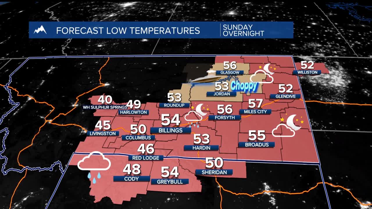
Sunday through Monday: Increasing precipitation chances as cold front moves through from west to east. Mountains and foothills have a 60-80% chance of at least 0.25" rain. Plains areas (including Rosebud County to the west including Billings and Yellowstone County) may see 0.1-0.2" with lower chances of significant amounts.
Starting as rain, snow levels drop to 9,000-10,000 feet Monday morning. Highest peaks could see a few inches, with 20% chance of 1" at Beartooth Pass and 30% chance of 2" on US-14 in Bighorns.
Expect breezy conditions Monday with gusts 20-30 mph widespread, and up to 35-45 mph with any thunderstorms. Temperatures will be cooler with highs Monday 60s form Billings westward to low 70s to the east.
Monday night-Tuesday morning: Coldest temperatures of the period with mid-30s west of Billings to mid-40s east. Areas of frost and freeze expected.
Tuesday-Weekend: Warming trend with mostly dry conditions under building ridge. Highs in the 70s and 80s.
