


BILLINGS — Strong winds especially west of Billings will have impacts Monday night through Wednesday.
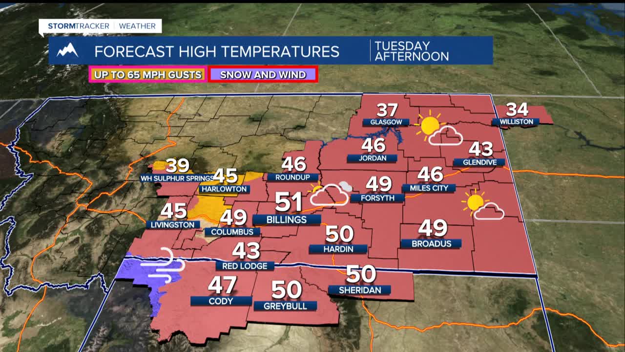
The National Weather Service has issued wind advisories and warnings for the western foothills, where residents in Livingston, Big Timber, and Harlowton should brace for wind gusts reaching up to 65 mph. The wind advisory takes effect at 2 a.m. Tuesday and remains in place until noon Wednesday.
The US-191 corridor faces even more severe conditions, with a High Wind Warning issued from 8 a.m. Tuesday through 11 p.m. the same day. Winds along this route could gust up to 60 mph, making travel extremely hazardous for high-profile vehicles.
While the western areas bear the brunt of the strongest winds, the rest of the region won't escape unscathed. Mid-week weather patterns will bring breezy conditions across the central plains, with sustained winds of 20-35 mph and occasional stronger gusts.
Adding to the concern is an unusual warm spell that has temperatures climbing 10-20 degrees above normal for this time of year. Highs will reach the 40s and low 50s through Wednesday, which is more typical of late March than early January. This warm weather, combined with the strong winds and recent lack of precipitation, creates a dangerous trifecta for grass fire development.
Meanwhile, the mountains tell a different story. The Absaroka-Beartooth range, particularly around Cooke City, will see persistent snowfall throughout the work week. Expect 10-20 inches of new snow through Thursday, making backcountry recreation difficult and potentially dangerous when combined with the strong winds.
The weather pattern shifts mid-week as another storm system moves through Wednesday, bringing more widespread breezy conditions but with less intensity than Tuesday's event. Light rain and snow showers remain possible across lower elevations, though significant accumulation is unlikely.
Temperatures will moderate Thursday and Friday, dropping to more seasonal levels in the 30s and low 40s, before another warming trend takes hold for the weekend. The return of dry, warm conditions – with highs again climbing into the 40s and 50s – means the fire danger concerns will persist.
