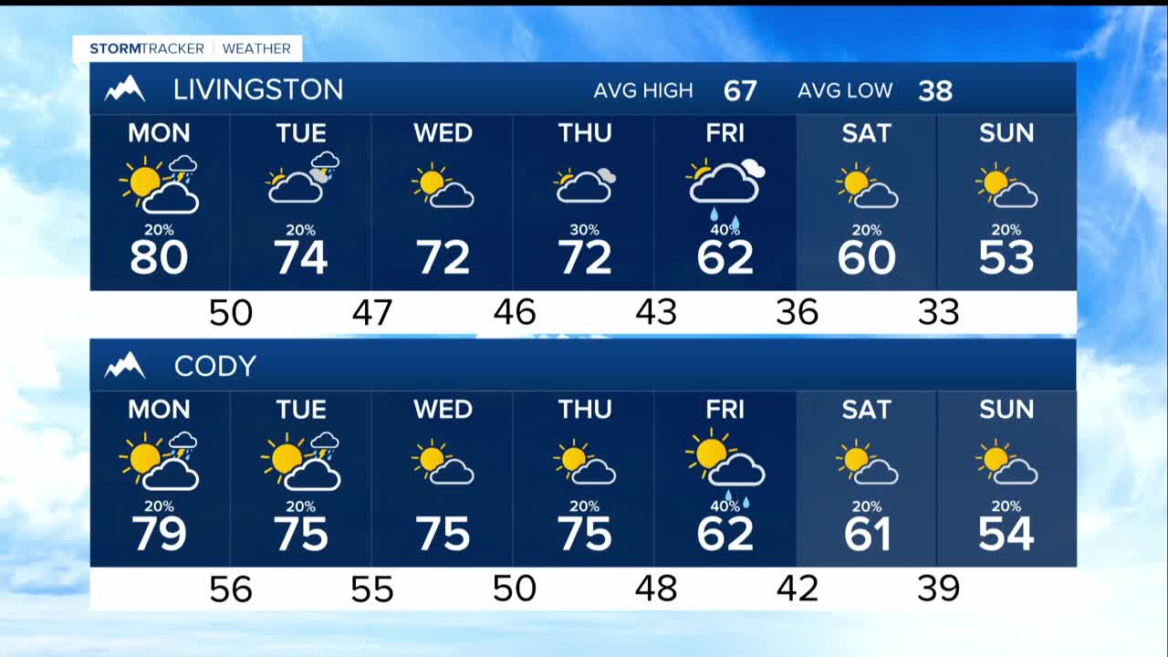


BILLINGS — Through Thursday, expect to bask in remarkably pleasant conditions. Upper-level atmospheric patterns are setting up shop, keeping temperatures into the 70s and 80s°F, a solid 10-20 degrees above what's typical for this time of year.
The Absaroka and Beartooth mountains will see the first hints of change, with southwest winds carrying just enough moisture to create 20-40% chances for precipitation Monday through Wednesday. By Tuesday, these shower chances will begin to spread their influence down to lower elevations, though the likelihood of more than a tenth of an inch remains very slim.
Starting Thursday, there is significant uncertainty in the computer models as a Pacific Northwest upper-level low begins its march inland. Temperatures will shift from above to near or below average, but the precipitation story becomes murkier.
As of now, the best bet is 20-40% precipitation chances for lower elevations from Thursday evening through Monday but the timing remains uncertain.
The weekend temperature story is clearer: expect a steady decline from Friday's pleasant 60s and low 70s°F down to the 50s and low 60s°F by Sunday.
Perhaps the most significant development involves the high country. Starting Thursday night, atmospheric conditions are aligning for what could be the season's first widespread snowfall in the Absaroka and Beartooth mountains.
Snow levels are forecast to settle around 8,000-9,000 feet. There is a 30-50% chance of accumulating more than 6 inches of snow over the weekend, although we'll be watching that through the week.
