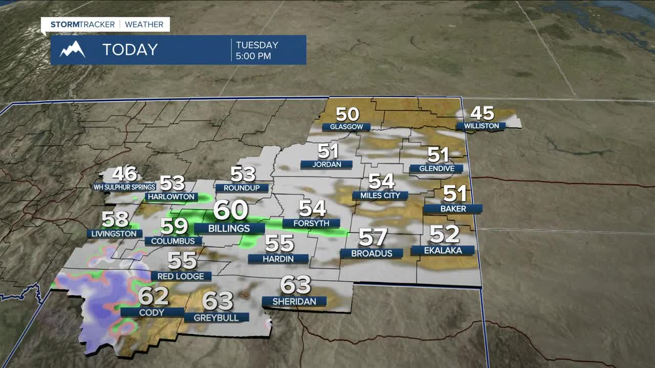


BILLINGS — There's a chance of rain on Tuesday as a shortwave sweeps through the area, with the best chance of up to a tenth of an inch of accumulation in the western mountains and foothills, while other areas can expect even less. The Beartooths and Absarokas could pick up a couple of inches of snow above 8,500 feet, mainly on west-facing slopes. Otherwise, it will be quite cloudy. Daytime highs will be in the mid-50s to around 60°.
High pressure will bring dry conditions back briefly on Wednesday before another disturbance moves through late Wednesday night into Thursday, bringing a chance of more light rain and a few inches of mountain snow above 8,000 feet. This system will have the potential to bring strong westerly wind gusts between 25–40 mph across most areas, with gusts over 50 mph across our western counties. Watch out for travel impacts from Livingston to Nye and Big Timber to Harlowton along I-90 and US-191.
Another system is expected to arrive late Friday into Saturday, bringing a better chance of widespread rain, but accumulations are still expected to be light. More mountain snow will be on tap for the Beartooths and Absarokas, with a few inches of snow above 7,000 feet. The Bighorns could also receive a few inches higher up. This system will also bring breezy to windy conditions, with gusts between 25–40 mph across much of the area.
Daytime highs are expected to remain milder than average until the end of the work week, in the mid to upper 50s most days, before cooling down into the mid-40s to lower 50s across the weekend.
Nighttime lows will be mainly in the low to mid-30s Tuesday night, mid-30s to low 40s on Wednesday night, low to mid-30s on Thursday and Friday nights, then upper 20s to low 30s across the weekend.
Miller Robson
Q2 Morning Meteorologist
miller.robson@ktvq.com
