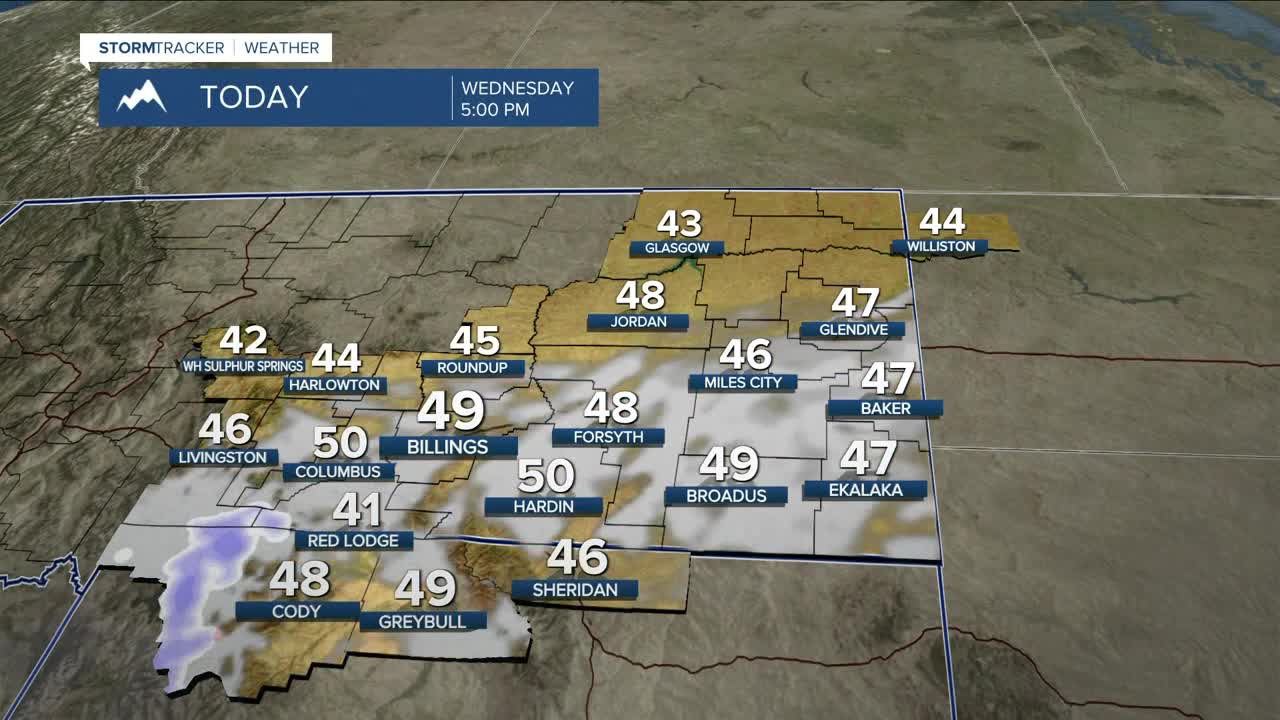


BILLINGS — The majority of the area will stay dry on Wednesday, but a shortwave coming out of the Great Basin will bring a chance of snow to the mountains through the evening, with 1–4 inches possible along the southwestern slopes of the Beartooths/Absarokas above 6,000 feet. The Bighorns could get a few inches, too. Cooke City could pick up 2–4 inches, while areas like Red Lodge and Gardiner could see light accumulation. Daytime highs will be mainly in the mid-to-upper 40s.
Mainly dry conditions should prevail Thursday through the weekend as temperatures warm into the upper 40s to low 50s across much of the region as downslope winds pick up a bit.
Speaking of wind, gusts up to 50 mph will be possible this weekend along the western foothills, especially in gap flow areas like Livingston and Nye, as a Pacific low begins to approach from the west.
Looking ahead to next week, Monday aims to stay dry with highs in the mid-to-upper 50s, but the Pacific low will bring cooler and unsettled weather beginning Tuesday, with a chance of rain and snow by the middle of next week. There is still some uncertainty with this, though.
Miller Robson
Q2 Morning Meteorologist
miller.robson@ktvq.com
