


BILLINGS — It’s a chilly start to Monday with temperatures near or below freezing across many locations. Some of our western counties could also see lingering snow, so watch for slick travel conditions along the US-191 corridor from north of Big Timber to south of Harlowton.
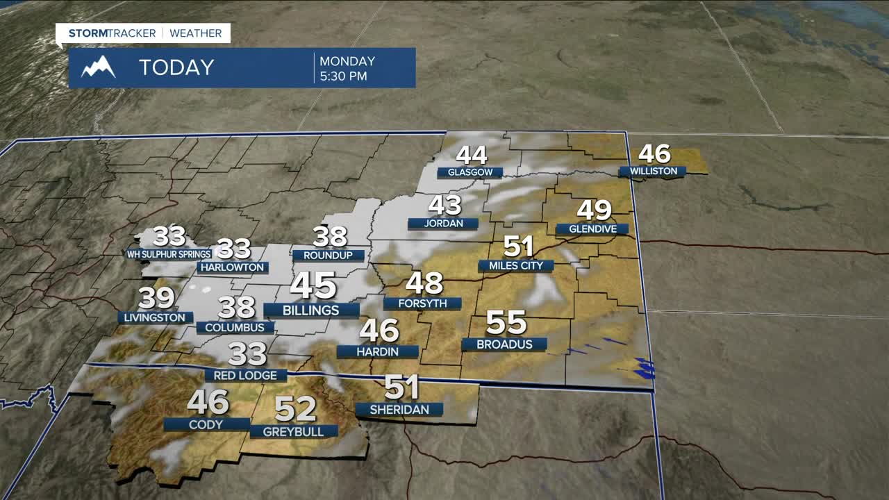
Monday will be mainly dry but cooler, with highs in the upper 30s west to mid-50s east. Billings is expected to reach the mid-40s.
Tuesday will also be dry for most of the day ahead of another area of low pressure that will bring a chance of rain starting Tuesday evening across our western counties before spreading eastward on Wednesday. This kicks off a couple of days of unsettled weather with daily widespread showers possible through Friday night as a couple of disturbances ripple through. Many locations could pick up around half an inch of rainfall.
Area mountains will also see chances for daily snow during this period. Snow levels will start around 9,500 feet Tuesday night, drop to 8,500 feet Wednesday afternoon, then slip down to around 7,000 feet Thursday morning. Four to eight inches will be possible, especially above 8,000 feet.
High pressure is expected to bring warmer and mainly dry conditions just in time for the weekend. Another system could bring more precipitation starting Sunday evening.
Daytime highs will be in the low 50s west to mid-60s east on Tuesday and Wednesday, low to mid-50s on Thursday, mid- to upper-50s on Friday and Saturday, then low to mid-60s on Sunday.
Nighttime lows will be in the mid-20s west to mid-30s east Monday night, 30s and 40s Tuesday through Thursday nights, 20s and 30s Friday night, then 30s Saturday night.
Miller Robson
Q2 Morning Meteorologist
miller.robson@ktvq.com
