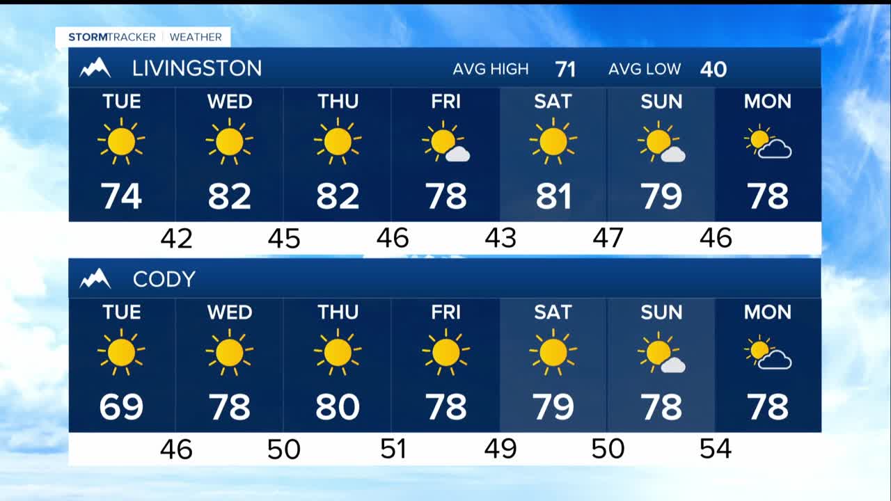


BILLINGS — The band of showers that has been falling through Monday across south-central Montana and north-central Wyoming will weaken and move south through Monday evening. After that, high pressure builds in bringing mostly sunny skies and warming temperatures through the weekend.
Mountain snow of 1"-2" is possible above 9,000-10,000 feet in the Beartooth/Absarokas, Pryors, and Bighorn Mountains. Additional precipitation of 0.1-0.25" is possible through Monday evening, then dry conditions prevail.
Tonight: Final showers exit around midnight, with possible patchy fog in river valleys through 9 a.m. Tuesday. Frost is possible in the Wheatland (Harlowton) and Golden Valley (Ryegate) County areas, so you may want to protect sensitive plants.
Tuesday: Clearing skies and breezy northwest winds of 20-30 mph in southeast Montana. High temperatures will climb to low 70s.
Wednesday-Weekend: Warm and dry with highs in the upper 70s to mid-80s under a building ridge.
