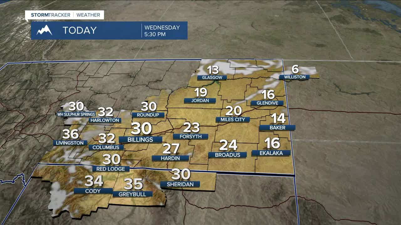


BILLINGS — Light to moderate snow will hang on early Wednesday morning along the western foothills and north-facing slopes in southern Montana and northern Wyoming. We may even get a few flurries in Billings. This should move out by late morning. Watch out for slick spots during the morning commute. It will be cooler, with daytime highs in the upper 20s and mid-30s, but far eastern Montana stays colder, holding in the teens and low 20s. Daytime highs will moderate back to around seasonal levels in the upper 30s to low 40s Thursday through Sunday, then may warm into the mid-40s to low 50s by early next week.
Wednesday night into Thursday morning, winds pick up again along the western foothills. The Livingston–Nye corridor gets the strongest blast, with a solid chance of 45–55 mph gusts and possibly reaching 60 mph at times. Big Timber to Harlowton will be windy too, with gusts of 30–45 mph. Watch out for blowing snow. Gap winds continue west of Billings through the weekend but may ramp up again early next week.
Northwest flow sticks around through the rest of the week and into next week, keeping us in an unsettled weather pattern with on-and-off rain, snow, and wind. The next better shot at widespread snow comes Thursday into Saturday in the mountains, and Friday into Saturday for the lower elevations. The southwest mountains — Absarokas, Beartooths, Crazies — are still favored for rounds of moderate to heavier snow on southwest-facing slopes, with up to a foot possible. Many locations across the lower elevations may pick up close to half an inch.
Miller Robson
Q2 Morning Meteorologist
miller.robson@ktvq.com
