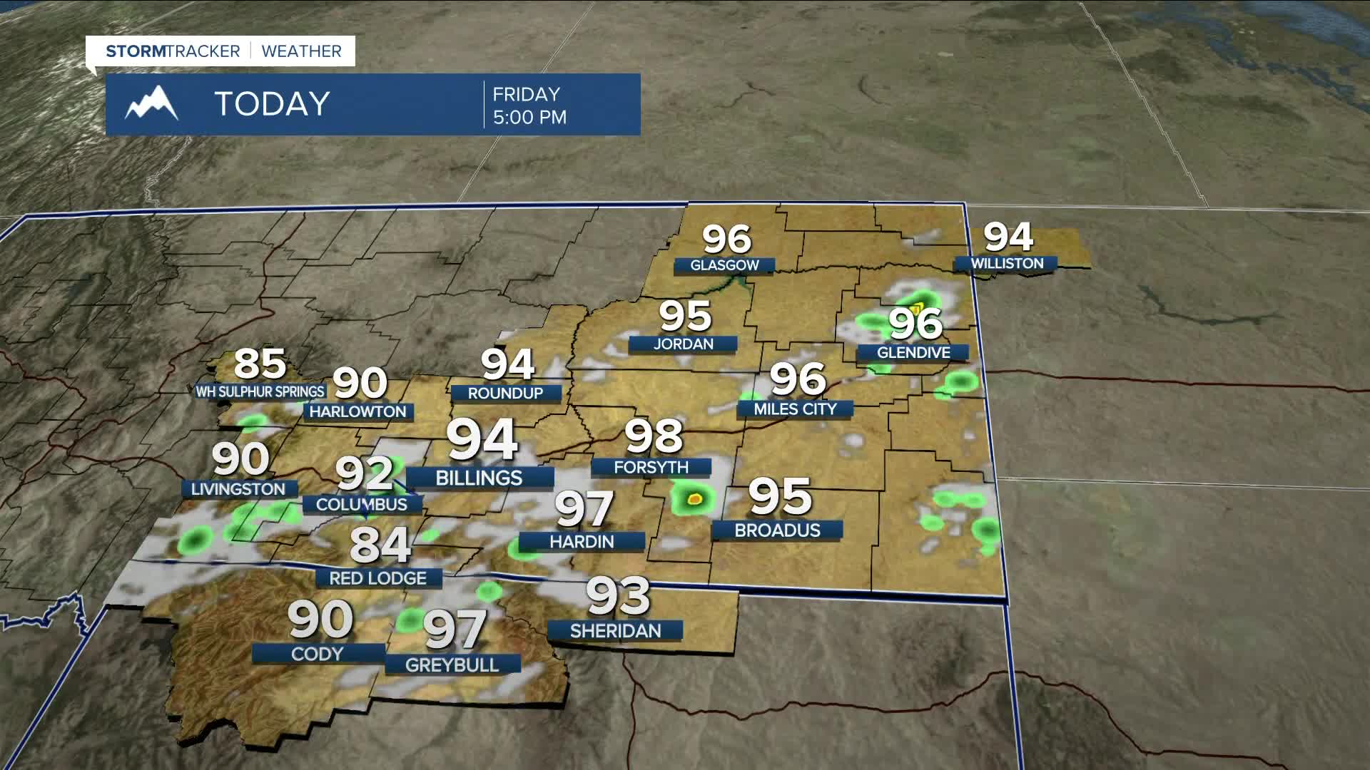


BILLINGS — Friday will be the warmest day of the week as daytime highs rise into the upper 80s to mid-90s under a fair amount of sunshine. Continued southwest flow will help steer a disturbance through the area, bringing a chance of isolated to scattered showers and thunderstorms during the afternoon and evening. Some storms could turn strong to severe, with strong gusty winds and small hail possible. Any storms that do develop could also produce periods of heavy rain.
Southwest flow looks to persist through the middle of next week, with several shortwaves moving through, maintaining a daily chance for showers and thunderstorms—some of which could become strong to severe. This will be something to keep an eye on.
Temperatures are expected to remain seasonal or close to it through the end of next week, with highs in the 80s and 90s over the weekend, then mainly in the mid-80s next week.
Nighttime lows will remain in the 50s and 60s through next week.
Miller Robson
Q2 Morning Meteorologist
miller.robson@ktvq.com
