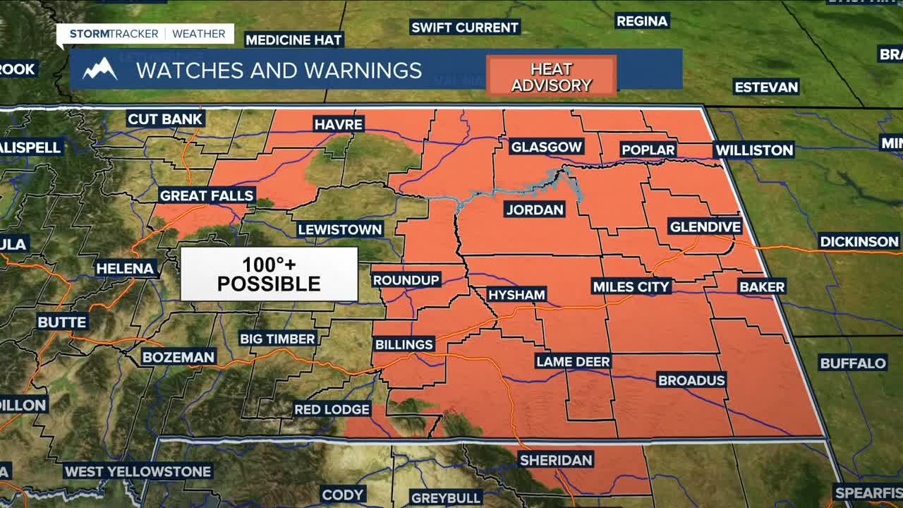


BILLINGS — Pre-frontal warming will help make Wednesday the warmest day of the week, with some locations cracking 100 degrees. Some records could even fall. A Heat Advisory will be in effect from 9 AM to 9 PM for much of the area. A chance of dry thunderstorms will begin to move in during the afternoon. These storms could produce lightning, but little to no rainfall is expected. This, combined with gusts over 40 mph, will heighten the risk of wildfires.
A cold front will move through beginning Thursday morning, keeping a chance of showers and thunderstorms in the forecast during the afternoon and evening hours as daytime highs cool to the mid-80s to low 90s. With more moisture moving in, a tenth of an inch or slightly more of rainfall will be possible Thursday night into Friday morning.
Rain moves out by late Friday morning and sunshine returns, along with even cooler daytime highs in the 70s, with 60s likely in the Red Lodge foothills.
The cold front will bring a chance of a few inches of snow from 10,000 feet and up over the Beartooths and Absarokas Thursday night into Friday morning. While it's not expected to make much of an impact on travel along the Beartooth Highway, be sure to monitor the forecast if you plan to head that way.
West to northwest flow aloft behind the exiting front will cause downslope flow on Saturday, bringing warmer temperatures with highs in the mid-80s to low 90s across the weekend.
The forecast from Sunday into early next week remains uncertain. While the NBM suggests continued warmth through Monday with highs in the lower 90s, a cold front on Tuesday could drop temperatures into the 80s and increase chances for precipitation.
Miller Robson
Q2 Morning Meteorologist
miller.robson@ktvq.com
