


BILLINGS — A big blast of cold Canadian air will drop temperatures over the next few days as winter makes a brief return. High temperatures will range from the teens to 30s Wednesday, teens and 20s Thursday, 20s and 30s Friday through Sunday, then warm back to the 40s and 50s by Monday. Nighttime lows will be in the single digits Wednesday and Thursday nights, single digits and teens Friday and Saturday nights, mainly teens Sunday night, then mainly 20s Monday night.
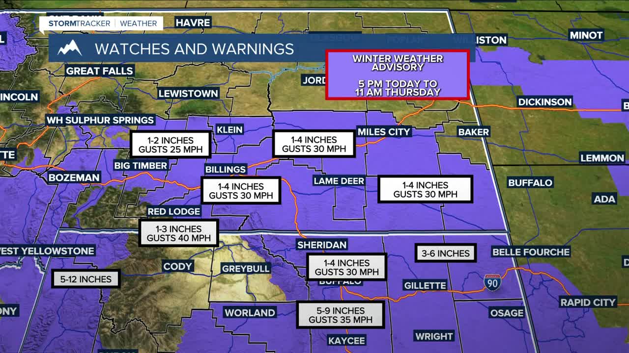
An upper low will push a couple of disturbances across the area through Friday, bringing a chance of snow. The first wave could bring generally 1 to 4 inches of accumulation across the area Wednesday evening through Thursday morning. The mountains could receive 2-6 inches of snow during this period. If these amounts do come about, then this will likely affect road conditions, impacting travel during the Wednesday evening and Thursday morning commutes. Gusts between 30 and 40 mph will also be possible, so blowing snow could reduce visibility. A Winter Weather Advisory will be in effect for much of the area.
The next wave will pass through Friday into early Saturday but will be weaker, so little to no accumulation is expected, although the mountains could pick up a few more inches.
High pressure is forecast to bring drier and warmer conditions across the weekend into at least early next week.
Miller Robson
Q2 Morning Meteorologist
miller.robson@ktvq.com
