


BILLINGS — A passing cold front will bring cooler (but still warmer than average) daytime temperatures Thursday and Friday, with highs mainly in the 40s and 50s.
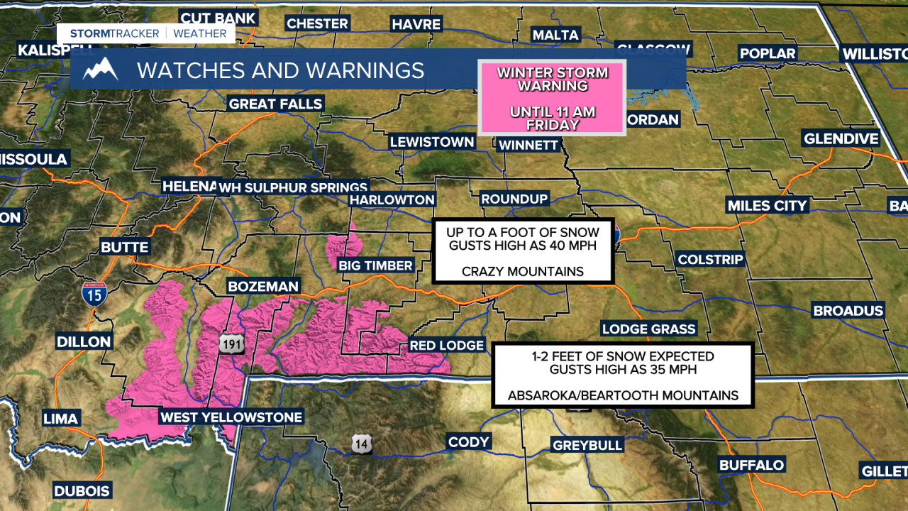
Confidence is high that a trough followed by a secondary wave will bring 1–2 feet of wet snow to the Beartooth Mountains and up to a foot in the Crazies through Friday morning. Gusts between 35–40 mph are expected as well. A Winter Storm Warning is in effect. The Beartooth, Red Lodge, and Sheridan foothills could pick up several inches, with gusts 30–35 mph. A Winter Weather Advisory will be in effect for those areas. A Winter Weather Advisory will also be in effect for the Pryors and Bighorns as well, where over 6 inches of snowfall and gusts up to 40 mph will be possible.
Mostly rain is expected in lower elevations, with a tenth to over a quarter inch possible, but some wet snow could mix in Thursday night. Little to no accumulation is anticipated.
High pressure will bring a return of dry conditions and warmer temperatures, with daytime highs in the 50s and 60s on Saturday, then mainly 60s on Sunday, with some locations aiming for record highs. A few spots, including Billings, could even approach 70 degrees.
Winds will turn stronger across the weekend, with gusts between 30–40 mph across much of the area and gusts between 60–70 mph from Livingston to Big Timber to Harlowton ahead of a cold front forecast to move in early next week. With warmer temperatures and drier air, this could lead to elevated grass fire concerns.
As for the cold front, there is still a good bit of uncertainty on the strength and impact it could have on the area as we near the middle of next week. Not only will there be a chance for mountain snow, but lower elevations could also see widespread snowfall as much cooler air sweeps down from Canada. We'll need to see how models align over the next couple of days in order to get a better handle on potential impacts from this system.
Miller Robson
Q2 Morning Meteorologist
miller.robson@ktvq.com
