


BILLINGS — Westerly winds are expected to carry smoke from Montana off into the Dakotas tonight. On Monday, a cold front moving down from the north may bring some light rain showers to Miles City and the eastern areas, but it will also shift winds to the north, possibly increasing smoke concentrations again.
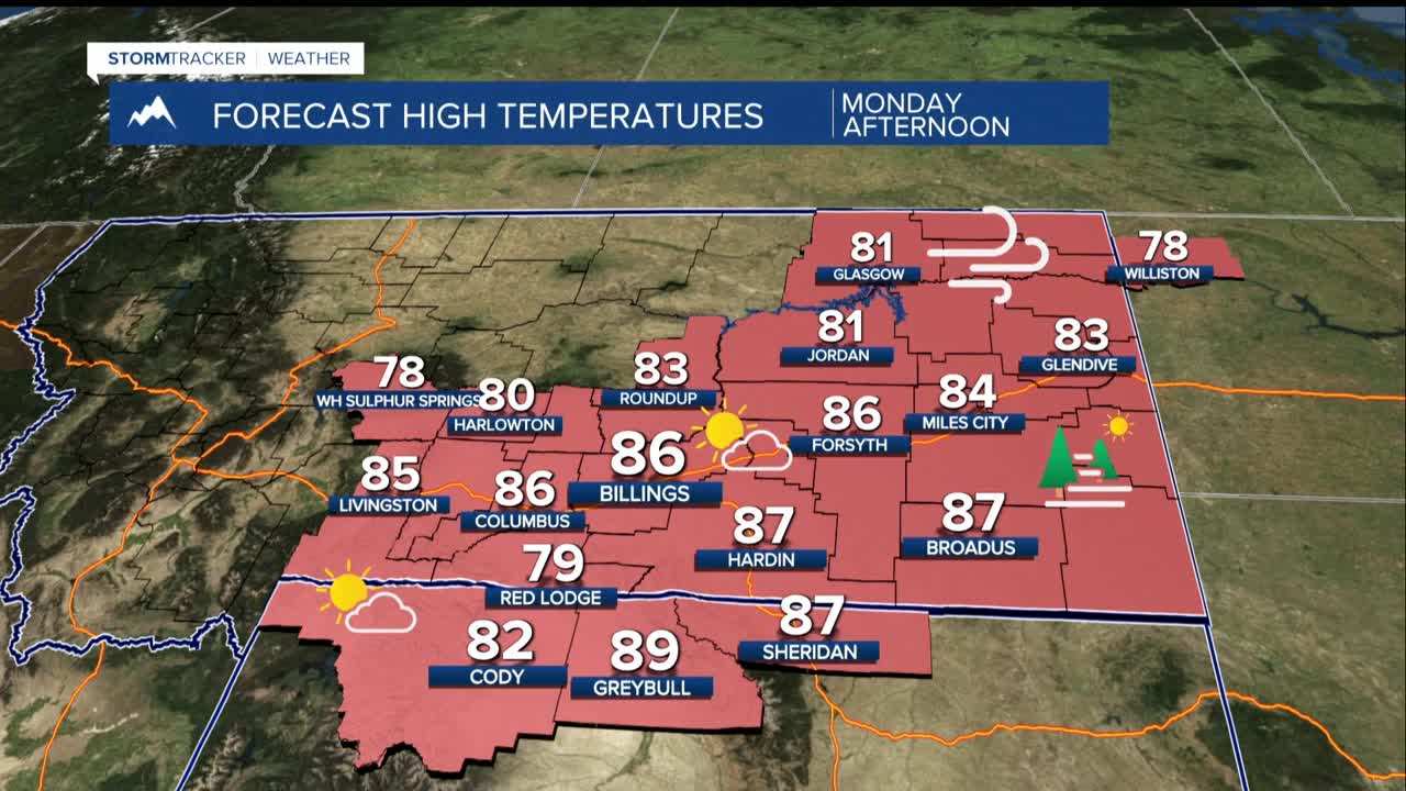
While current models suggest that smoke levels will remain lower than before, there could still be reduced air quality and hazy skies. From Monday to Tuesday, temperatures will continue to rise into the 80s and low 90s due to a northwest flow.
Looking ahead to Wednesday through Saturday, Wednesday is likely to be the hottest day of the week, with temperatures expected to reach the upper 90s. A HeatRisk level of 2 out of 4 means that those sensitive to heat should take precautions to stay cool and hydrated.
After Wednesday, a pattern change is expected, but temperatures will only slightly decrease. A strong southerly wind may bring in moisture from the Gulf, increasing the potential for storms. There’s a small chance for severe storms as the week progresses, with temperatures hovering around normal or slightly above normal for this time of year.
