


BILLINGS — A Wind Advisory was issued Monday night near the mountains with gusts to 70 mph. Then we warm up to near-record highs by Thursday. Cooler and unsettled weather returns Friday.
Monday night and Tuesday, very gusty winds in the Livingston-Nye foothills and Big Timber to Harlowton should gust from 50-70 mph. Wednesday will be much calmer, but by Thursday night, winds pick back up.
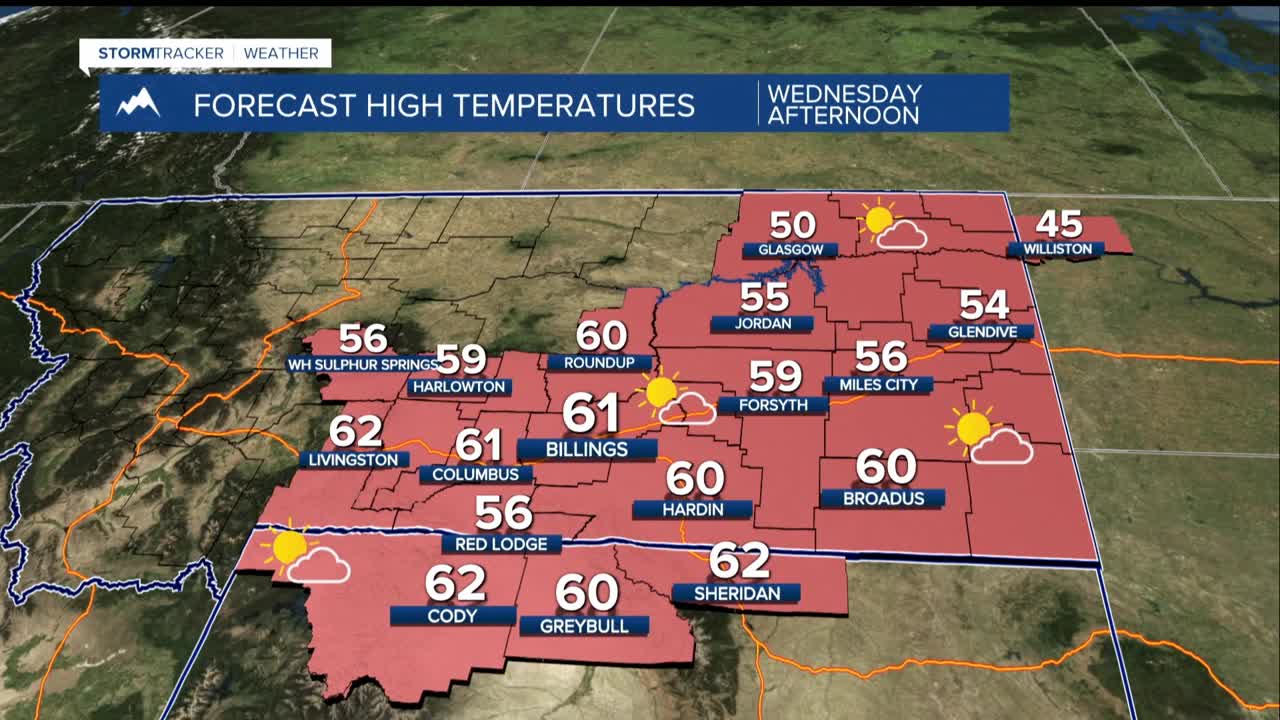
Way warmer than normal through Thursday, with highs well into the 50s to mid-60. Some spots might at least challenge daily high temperature records, especially on Thursday, when we could hit 70 degrees in some areas - more like late spring than November.
By the weekend, we have to be honest about uncertainty: There is a lot of it, starting with Friday's high temperatures. Cooler air moves in Friday, likely pushing us into the 40s and 50s for the weekend, but the timing on the front will have a huge influence on Friday's temperatures.
Friday's high in Billings could be anywhere from 40 to 65 degrees. We will narrow that down as the timing and intensity of the arriving trough becomes clearer.
The weekend brings unsettled conditions with possible rain/snow mix, and the mountains could see snow showers. Expect more wind possible from late Thursday through Friday.
