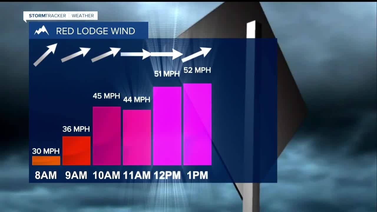


MONDAY NIGHT INTO TUESDAY MORNING: Beginning around 2-3 a.m., powerful mountain wave winds could slam into the region. Bighorn and Pryor foothills face the first wave with gusts reaching 60-70 mph.
By late morning, the assault shifts to Absaroka and Beartooth foothills, where wind gusts of 70-80 mph are possible. These aren't just strong breezes; these winds can snap trees, topple power lines, and affect travel.
TUESDAY: A powerful cold front crashes in with winds gusts of 50-65 mph sweeping across the plains from late morning through early evening. Temperatures still reach the 40s and 50s, so the combination of warm temperatures, fierce winds and bone-dry conditions create a dangerous fire weather situation. Any spark could ignite a grass fire that spreads rapidly out of control.
Late in the day, light rain and snow showers begin moving through, with mountains picking up a few inches of snow.
TUESDAY NIGHT: The bottom drops out as Canadian cold air floods in behind the front. Temperatures plummet from the day's mild conditions into the teens.
WEDNESDAY-THURSDAY: Much colder air brings the first significant low-elevation snowfall in quite a while. Expect 1-3 inches of accumulation with the highest amounts likely in southern and southeastern areas. Temperatures stay locked in the teens to low 30s. This represents a complete transformation from the weekend's spring-like feel.
FRIDAY-SATURDAY: Additional light snow showers remain possible as another dose of Canadian cold air keeps temperatures well below normal in the 20s to 30s. Conditions gradually stabilize.
SUNDAY-MONDAY: The gradual recovery begins as high pressure builds back in, allowing temperatures to climb back into the 40s and some areas will reach the 50s by Monday.
