


BILLINGS — Warm and dry weather is in the area, with most high temperatures reaching the 80s Monday. On Tuesday, we might see some scattered showers and storms, especially in the mountains, thanks to some moisture moving in.
If storms do develop, they could bring strong gusty winds. There’s a small chance for stronger storms in southeast Montana late Tuesday, and areas west of Billings closer the high elevations.
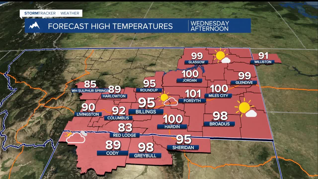
From Wednesday to Sunday, a high-pressure system will keep temperatures well above early July averages, reaching the mid to upper 90s, and possibly hitting 100 degrees in some spots on Wednesday. It will feel hot and humid, with a chance of afternoon showers and thunderstorms.
On Thursday, temperatures will cool off slightly, dropping by about 5 to 8 degrees, but moisture in the air will increase the chances of rain. Some of the rain may be heavy with high moisture levels and slow moving storms.
By Friday, a weather system coming from the northwest will bring more cooling for the Fourth of July, bringing temperatures back down to the low to mid 80s, with continued chances for showers and storms throughout the weekend.
Even though it will be quite hot this week, these temperatures are typical for this time of year in the northern Rockies. However, the combination of heat and humidity could be a concern, so people with outdoor plans should take precautions to stay safe in the heat.
