


BILLINGS — A large, stubborn high-pressure system is "parked" over western North America, creating a weather pattern that's keeping Montana much warmer and drier than usual for this time of year.
A "negative North Atlantic Oscillation" is blocking normal weather patterns from moving through, keeping this high pressure ridge locked in place over the West. As a result, Billings set a new record high for December 31, reaching 56° at the Billings Airport Tuesday afternoon.
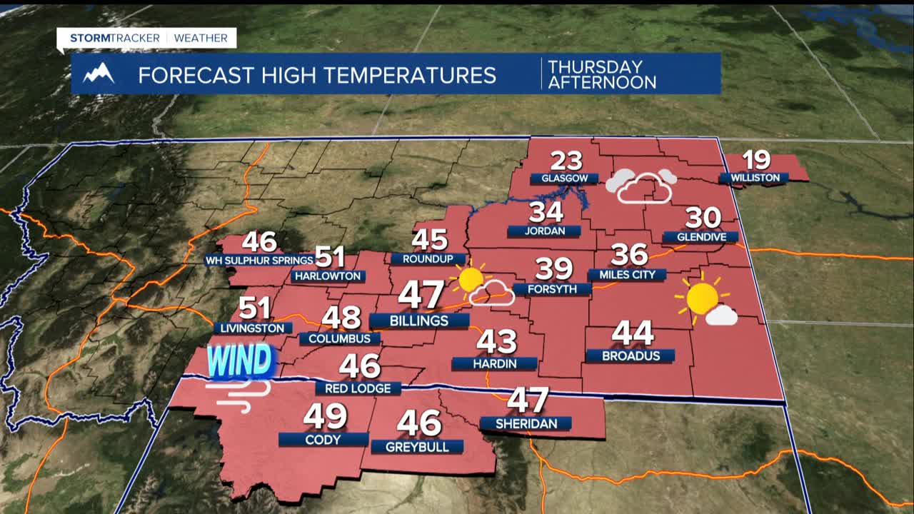
Strong winds will continue down the foothills west of Billings through Thursday morning. Top gust in Livingston was 62 mph and a 49 mph gust was recorded in Big Timber on Tuesday,
Forget typical January temperatures in the 30s for highs. Readings will stay well above normal into next week with most area highs in the 40s and 50s. This unusually warm pattern is expected to persist through the first week of the new year.
Snow? Don't expect much. The region will stay mostly dry, though the higher elevations of the Absaroka-Beartooth Mountains could see light snow Friday into early next week, mainly on west and south-facing slopes.
Montana's early January is looking more like fall with strong winds and surprisingly mild temperatures continuing through the holiday week.
