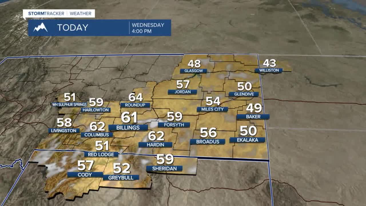


BILLINGS — Warmer-than-average temperatures will remain across the area through the weekend, with highs in the low 50s east to mid-50s to low 60s elsewhere on Wednesday. Billings and Cody, WY, will have a chance at records. Thursday will be the warmest day of the week, with highs in the upper 50s to mid to upper 60s. Many locations, including Billings, Livingston, Miles City, and Sheridan, WY, could see record warmth.
We can expect breezy to windy conditions on Wednesday, with gusts of 30–50 mph out of the west/southwest possible, the strongest winds across the western foothills. Winds will decrease into the evening.
High pressure will keep dry conditions locked in through the weekend. This, combined with occasionally breezy and warmer-than-average conditions, will keep an elevated risk for grass fires this week. Don't cause a spark!
Models are suggesting a possible shift to a cooler and wetter pattern early next week, with a decent chance of snow in the mountains. There is quite a bit of uncertainty on how cool it could get in the lower elevations, so whether it will rain or snow is still up in the air. Stay tuned.
Miller Robson
Q2 Morning Meteorologist
miller.robson@ktvq.com
