


BILLINGS — We are experiencing cooler and wetter weather than usual for July as a low pressure trough is centered over Montana. Through Tuesday evening, stronger southwest winds will accompany more rain and even some thunderstorms, especially in southern parts of Montana and northern Wyoming.
There's a slight chance that some of these storms could be severe, bringing large hail, strong winds, and heavy rain. That brings concerns for flash flooding, particularly in areas recently affected by wildfires.
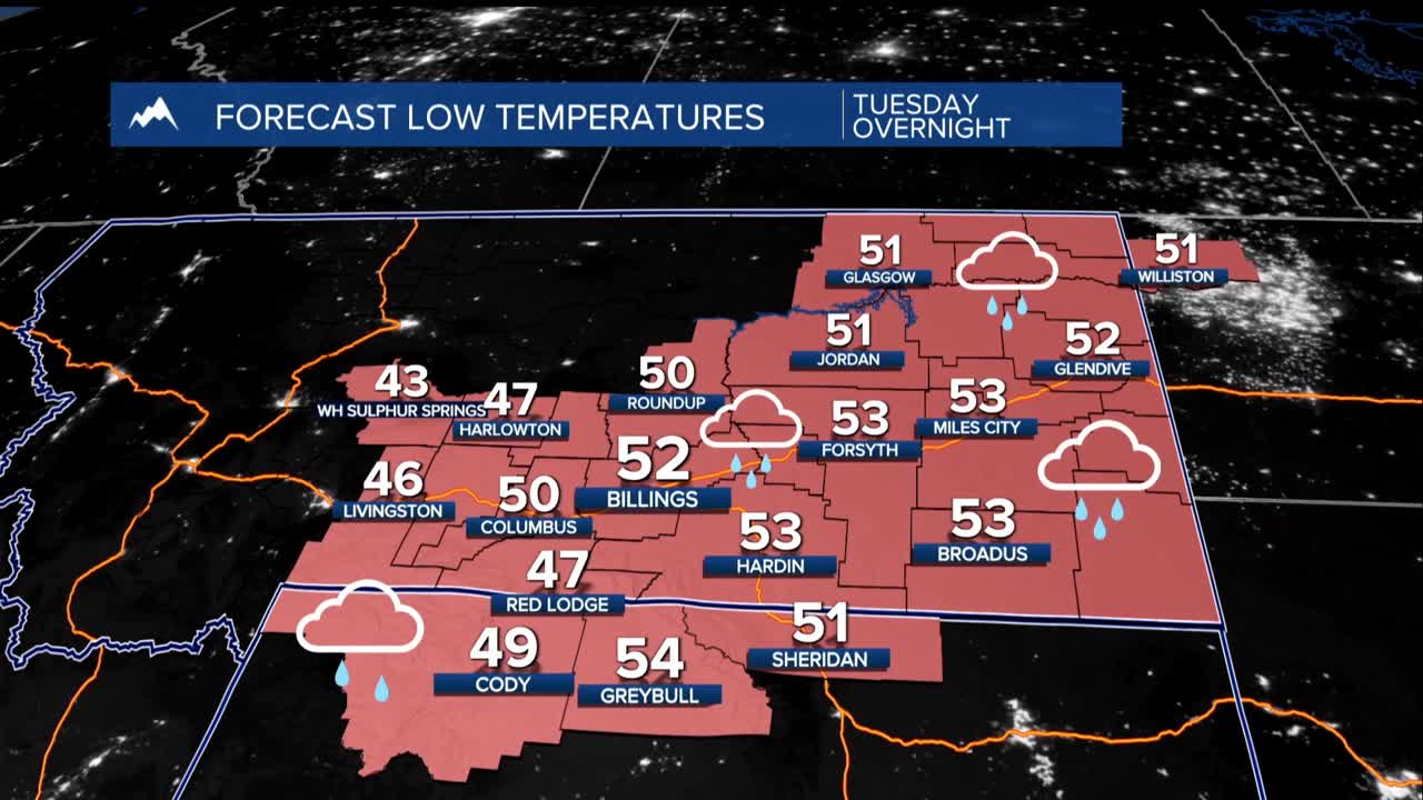
The heaviest rain is expected Tuesday night through Wednesday morning, tapering off by Wednesday afternoon. Wednesday will feel cool, with high temperatures only reaching the mid-60s.
After the rain, we might see fog develop Thursday morning due to lingering moisture, and temperatures won't drop too low—likely staying above the 40s.
As we move into Thursday, the weather will dry out and warm up a bit, with highs in the lower to mid-80s. A cold front may bring a small chance of rain and possible thunderstorms Thursday night into Friday, and there could be some afternoon showers on Friday as well.
For the weekend, expect warm temperatures in the upper 80s to lower 90s, but there’s a chance for late-day showers and thunderstorms. By early next week, the weather models suggest that a new cold front may approach from the northwest, which could lead to more rain and cooler temperatures, especially on Monday, when severe storms could also develop.
