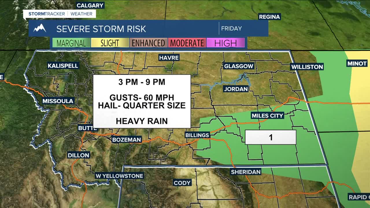


BILLINGS — A cold front will bring a slightly better chance of showers and thunderstorms during the afternoon and evening on Friday. While only general thunderstorms are expected, isolated strong storms are possible, and a few severe storms could pop up across portions of the eastern plains. Gusts up to 60 mph, small hail, and brief heavy downpours will be possible. Daytime highs will be slightly cooler, in the low to mid 80s, but portions of eastern Montana could reach the low 90s.
Outside of a few isolated showers and thunderstorms, expect dry conditions across the weekend through early next week as high pressure digs in. Temperatures will be near-seasonal or warmer on Saturday and Sunday, with highs in the low to mid 80s.
It will warm up beginning Monday, with daytime temperatures pushing into the mid to upper 80s, with some lower 90s through the middle of next week.
Some models are forecasting another disturbance moving through by midweek that could produce strong to severe storms.
Miller Robson
Q2 Morning Meteorologist
miller.robson@ktvq.com
