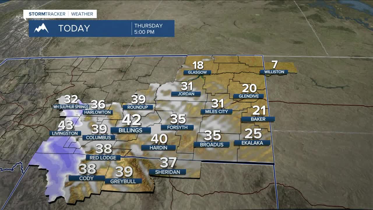


BILLINGS — Strong winds will ease from west to east Thursday morning as a powerful upper low shifts into the Dakotas. It will be cooler, with highs mainly in the 20s east and 30s to low 40s elsewhere.
Winds ramp back up late Thursday afternoon and evening across the western foothills as pressure gradients tighten and mid-level winds strengthen. Strong winds develop first in gap areas like Livingston and Nye, then spread into the US-191 corridor overnight. Gusts of 30–45 mph will be common, with higher gusts possible near the foothills due to mountain wave activity tonight into Friday morning. High Wind Warnings are in effect for Livingston, Nye, and the Big Timber area, with High Wind Watches elsewhere across the foothills where confidence is lower.
Snow increases in the western mountains this afternoon as Pacific moisture moves in, with a prolonged period of accumulating snow expected through Saturday in the Beartooth and Absaroka Mountains. A Winter Storm Warning will be in effect. Rain and snow reach lower elevations Friday afternoon and evening, with light accumulations possible along the foothills.
Into the weekend and early next week, zonal flow keeps temperatures above normal with periodic mountain snow, while lower elevations stay mostly dry.
Miller Robson
Q2 Morning Meteorologist
miller.robson@ktvq.com
