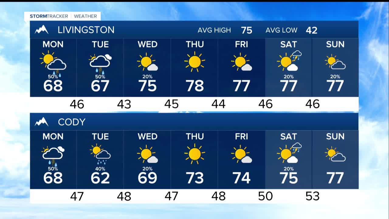


BILLINGS — A trough and an associated cold front that will push a period of rain and the potential for embedded thunderstorms as cooler air moves in. Unsettled weather remains through midweek, with wet roads, possible gusty winds around storms and cooler temperatures than typical for mid-September.
The chance of precipitation ramps up through Monday as the low and front sweep through the region.
Forecast timeline and rain chances. Highs will ranges from 60s west of Billings, 70s near Billings and the surrounding counties, and low 80s to the east.
Chances for rain increase to 30%–70% as the system moves from west to east across the area Monday through Monday night. Tuesday will be cooler with highs in the upper 60s to 70s with a lingering chance of showers through Wednesday morning.
Rainfall totals from late Sunday through Tuesday will range from 0.10" to 0.70" , with heaviest amounts in the mountains and areas east and south of Billings, plus around a few thunderstorms. Along with heavier rain, thunderstorms have the potential for strong wind gusts. There could be light amounts of mountain snow.
By Thursday heading into the weekend, our forecast uncertainty grows. Some ensembles hint at the Monday low stalling in the Plains, with energy moving through eastern Montana; others keep the pattern more tranquil. Overall, precipitation generally remains low (mostly below 30%), with temperatures near to a little above seasonal norms.
