


BILLINGS — A Pacific wave slides across the region on Wednesday, bringing a slightly better chance of scattered snow showers to the mountains above about 6,500 feet, along with lower-elevation light rain showers. Areas east of Yellowstone County could see pockets of dense morning fog. Daytime highs will be in the mid-40s to low 50s under partly to mostly cloudy skies.
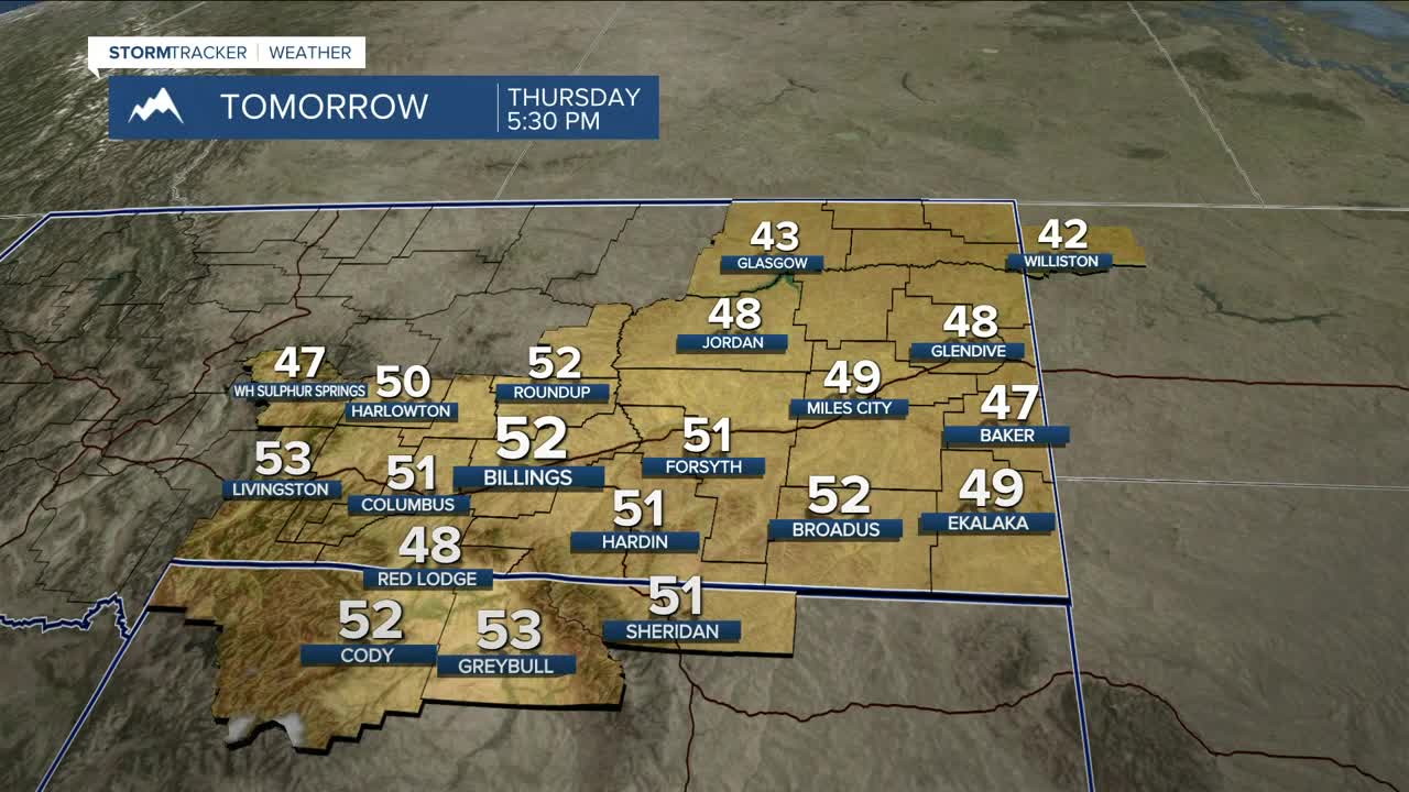
The weather will be rather quiet Thursday through Sunday as weak ridging (high pressure) or zonal flow takes over, bringing dry conditions with a good dose of sunshine across the area, including the higher elevations. Daytime highs will be mainly in the upper 40s to upper 50s during this stretch.
By Friday night, gap-flow winds will strengthen a bit across the western foothills through the weekend. An advisory may be warranted.
Lots of questions about next week as the Thanksgiving holiday approaches. Monday still looks dry and about 10° warmer than normal, but confidence is high that a considerable cooldown will move in starting Tuesday as colder air drops down from Canada. Highs are expected to fall into the 30s with lows in the 10s and 20s through the weekend.
As far as rain and snow next week, it's still too early to tell what impacts, if any, could occur for holiday travel. We'll have a better handle on the situation over the next couple of days. If you do plan to travel, prepare accordingly and stay tuned.
Miller Robson
Q2 Morning Meteorologist
miller.robson@ktvq.com
