


BILLINGS — For residents east of Billings, colder air isn't ready to loosen its grip just yet. Cooler temperatures and a slightly wetter pattern will dominate through the weekend, bringing two opportunities for light snowfall. The first chance arrives Thursday, followed by another possibility Saturday.
The snow won't be more than a coating. Areas near the North Dakota border have the best shot at accumulating snow, with some locations in the southeastern Montana hills potentially picking up around two inches through Thursday night.
The persistent cold in these eastern regions means any precipitation that falls will likely stick around as snow. Highs east of Billings will stay in the 20s and 30s until the weekend.
Meanwhile, south-central Montana and north-central Wyoming are experiencing a completely different story. Warmer, drier conditions will prevail through the weekend, with temperatures climbing to the 40s in the short term and 50s by the weekend.
A few locations might even challenge daily temperature records, turning January into something that feels more like early spring.
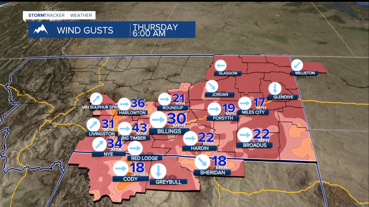
Communities in the foothills west of Billings, including Big Timber, Harlowton, Livingston and Nye will continue to get periodic strong winds throughout the week. While not extreme, these gusts combined with the unseasonably warm temperatures and dry conditions could create elevated fire danger concerns heading into the weekend.
