


BILLINGS — Brutal cold is about to take center stage across eastern Montana and the Dakotas, with the mercury plummeting to the season's coldest temperatures yet.
Starting Thursday, winds will finally calm down from recent days. Bitter cold air will settle in through the early part of the weekend. Light snow will dust parts of the region Thursday through Saturday, though accumulations should remain modest.
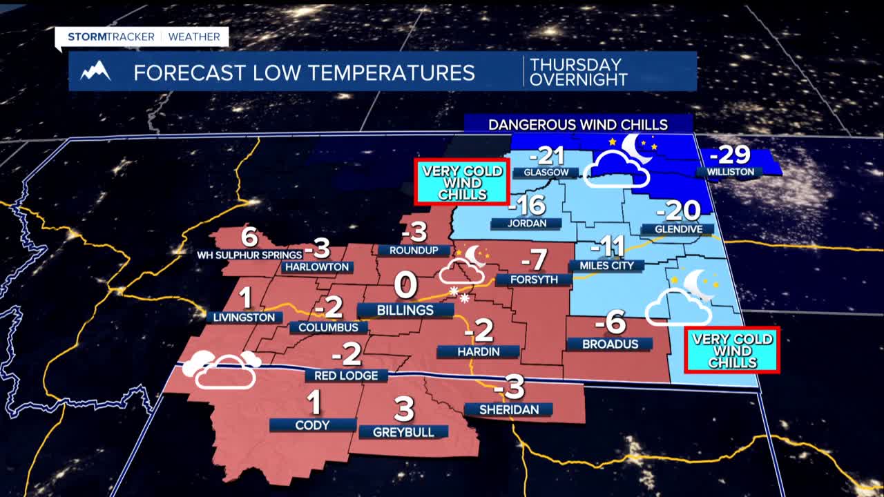
By Friday morning, thermometers crash to lows in the single digits above to the teens below zero. Eastern counties along the Dakotas border face the harshest conditions, where temperatures could dive as deep as 20 degrees below zero. Even with lighter winds, wind chills will make it feel like 10 to 30 below, and create a threat for frostbite and hypothermia.
This arctic blast represents the winter's coldest air mass so far, driven by a powerful high-pressure system camping out over the northern plains. The combination of sub-zero temperatures and even light breezes will create hazardous conditions, prompting Cold Weather Advisories for Thursday afternoon through Friday morning east of Billings, and through Saturday in northeast Montana where some counties are under an Extreme Cold Warning with potential wind chills of -30° or colder.
A warming trend should begin this weekend or early next week, though computer models still disagree on exactly when milder air arrives and how quickly temperatures rebound. When the pattern does shift, residents along the western foothills can expect those familiar gusty winds to return as part of the package.
