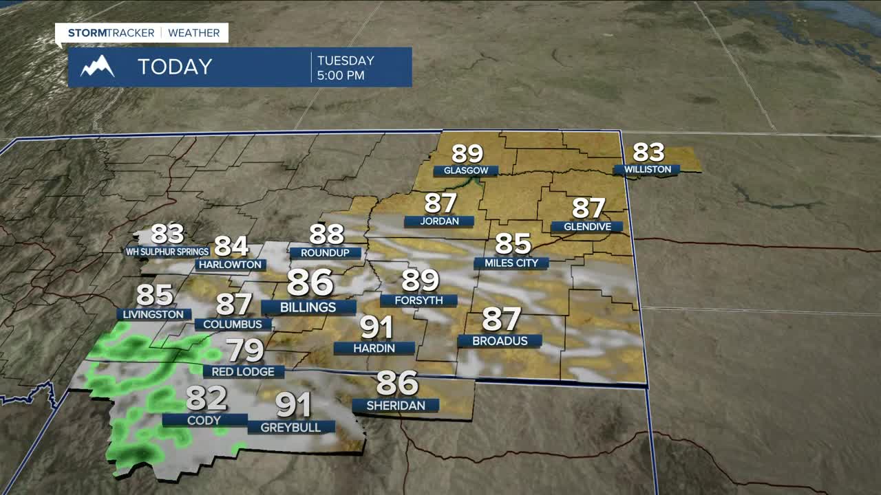


BILLINGS — Most of the area will stay dry on Tuesday, with daytime highs mainly in the upper 70s to mid-80s. Skies could be very hazy at times due to wildfire smoke. Southwest flow will bring a chance of showers and perhaps a few thunderstorms across the Beartooths/Absarokas and adjacent foothills during the afternoon, which could linger into the overnight hours. Some rain could be heavy at times.
A bigger push of monsoonal moisture will move into southwest Montana and northern Wyoming on Wednesday, bringing a much better chance of rain and thunderstorms over the western mountains and foothills, some of which could produce periods of heavy rainfall at times. Billings will start to see rain chances increase by Wednesday night. Wednesday’s daytime highs will remain mainly in the upper 70s to mid-80s.
Chances of thunderstorms with heavier rain will increase on Thursday and Friday as an area of low pressure moves across northern Wyoming. While severe weather doesn’t look likely at this time, slow-moving storms could bring a risk of flash flooding in susceptible areas, especially burn scars. The rain will also bring cooler temperatures, with highs in the 70s on Friday and Saturday.
High pressure will bring drier conditions for the weekend, but some lingering rain is possible on Saturday. Sunday and Monday are expected to be warmer and drier, with temperatures rising into the 80s, slightly above normal for early September.
Nighttime lows will be mainly in the 50s and 60s through Thursday night, then cool to the 40s and 50s on Friday night and through the weekend.
Miller Robson
Q2 Morning Meteorologist
miller.robson@ktvq.com
