


Tuesday night-Wednesday: A weather system from California bringing moisture to our mountains. The Beartooth, Absaroka, and Bighorn ranges could see light snowfall Wednesday, with the best chances in the higher elevations. Don't expect a major snow event with less than a 20% chance of getting more than 6 inches.
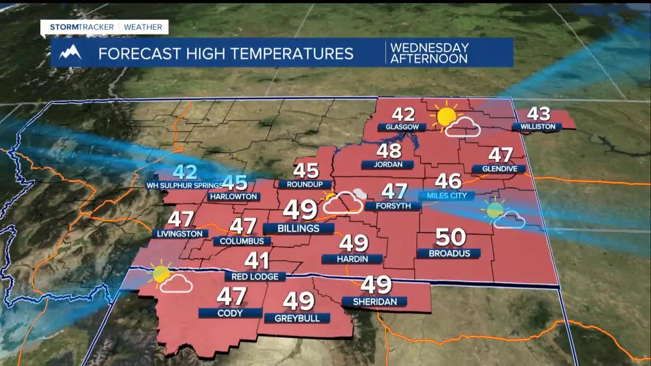
Wednesday-Friday: The middle of the work week brings relief from recent windy conditions. Temperatures will feel pleasant with highs running 10-15 degrees warmer than typical for this time of year in the 40s and low 50s.
Friday Night: Gusty west and southwest winds may fire up again in the western foothills. If you have weekend outdoor plans in these areas, Friday night could be your last calm evening for a while.
Saturday: The mild, above-normal temperature trend continue before things become more unsettled.
Sunday Onward: A major weather pattern change arrives Sunday. A persistent weather system over the West Coast will likely send multiple disturbances our way through the middle of next week. This means cooler temperatures and higher chances for precipitation, marking the end of our current quiet spell.
