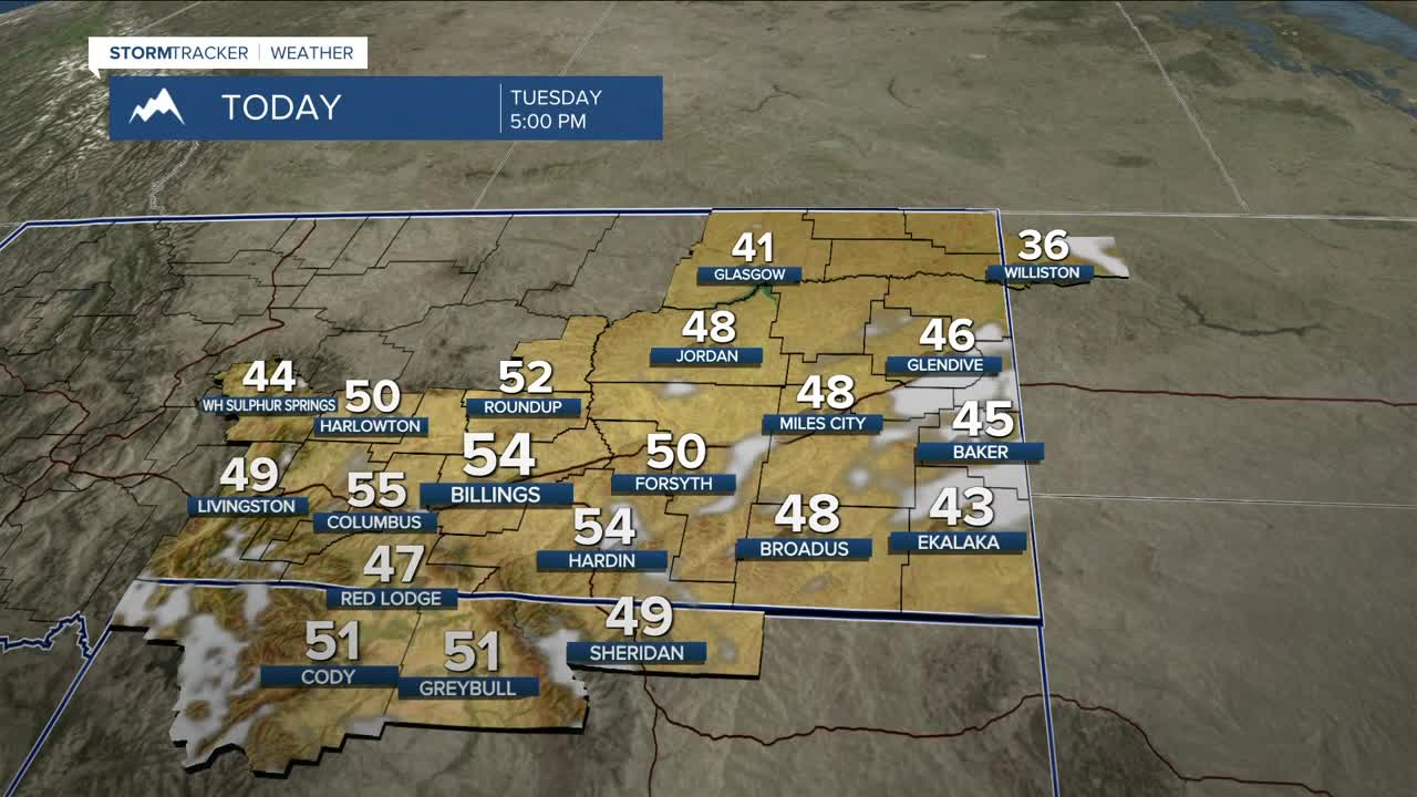


BILLINGS — A shortwave disturbance will sweep through the region on Tuesday, bringing a chance of rain, snow, or a mix during the morning hours, especially in eastern MT. Northwest-facing slopes of area mountains could pick up a few inches of snow, with the best chance in the Bighorns.
Patchy freezing fog is possible from Miles City to Baker to Ekalaka, so watch out for slick roads, sidewalks, bridges, and overpasses Tuesday morning. A Dense Fog Advisory is in effect through 10 AM for northeast MT where visibility could be reduced to less than one quarter mile at times.
The disturbance will also bring breezy winds across much of the area on Tuesday, with gusts between 20–30 mph, but the western foothills could feel gusts into the 40 mph range through lunchtime.
Moving forward, high pressure will lock in dry conditions through the rest of the week as daytime temperatures get warmer, with highs in the 50s to low 60s Wednesday through the weekend. Some locations could even see record warmth on a few days. Thursday is still on track to be the warmest day of the week, with highs in the upper 50s to mid to upper 60s.
A reminder that there is an elevated risk for grass fires this week because of the dry, breezy, and warmer-than-normal conditions. Don’t cause a spark!
While outlooks are showing a continuation of warmer-than-average temperatures next week, some models are suggesting a change to a brief cooler pattern with a better chance for snow. Confidence that this will actually happen is very low at the moment, though.
Miller Robson
Q2 Morning Meteorologist
miller.robson@ktvq.com
