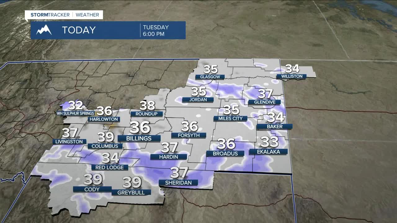


BILLINGS — A fast-moving system slides through Tuesday into Wednesday morning, bringing snow (and a bit of rain), breezy winds, and cooler temperatures. Two rounds of precipitation are expected: light snow Tuesday morning, then a stronger round late Tuesday afternoon and evening as a cold front drops in from the north. That second wave will favor the mountains, foothills, and higher elevations of southern Montana and northern Wyoming, with upslope flow boosting snowfall through early Wednesday. Light snow may hang on into the morning before downslope winds shut things down by midday.
Lower elevations see a rain/snow mix Tuesday with temperatures in the 30s, then all snow Tuesday night. Most areas will get a dusting to a few inches, with higher totals on north-facing slopes. Mountain totals run 5–10 inches. Northerly gusts of 15–30 mph Tuesday night could cause some blowing snow and reduced visibility, and any wet roads will refreeze as temperatures drop into the teens and single digits.
Winter Weather Advisories remain in place for parts of the southern foothills, southeast Montana, and the northern Bighorn/Pryor Mountains. The Bull Mountains could pick up 1–2 inches, possibly more if that northern flow locks in.
Once the snow ends Wednesday morning, we dry out, but temperatures stay cold — in the teens and 20s in the east, and in the 20s and 30s farther south.
The rest of the week stays active with northwest flow, bringing occasional wind and light precipitation, especially near the foothills west of Billings. Temperatures will bounce between the 20s and 40s with each passing disturbance. If you’ve got travel or outdoor plans later this week, keep an eye on the forecast.
Miller Robson
Q2 Morning Meteorologist
miller.robson@ktvq.com
