


BILLINGS — Breezy winds will decrease this evening with warmer than average and dry days from Tuesday through Friday. There's a 40-60% chance of breezy to strong winds over the western foothills late Friday through Saturday signaling cooler and more unsettled over the weekend.
Wind gusts of 30-40 mph in the western foothills and 20 to 30 mph across much of the region Tuesday afternoon and evening is easing. These breezy conditions will quickly come to an end by this evening.
Confidence is high that an upper-level ridge will build over our region, keeping conditions warm and dry. While a few weak disturbances may bring high clouds, any precipitation is very unlikely - less than 10% chance - as moisture levels will remain below to near normal.
Ahead of an approaching weather system, we're seeing signs of another round of stronger winds over the western foothills. These areas can see gusts exceeding 50 mph from Friday night through Saturday evening.
A trough is expected to move in from the west, bringing cooler and wetter conditions. However, uncertainty remains regarding exact timing and impact extent.
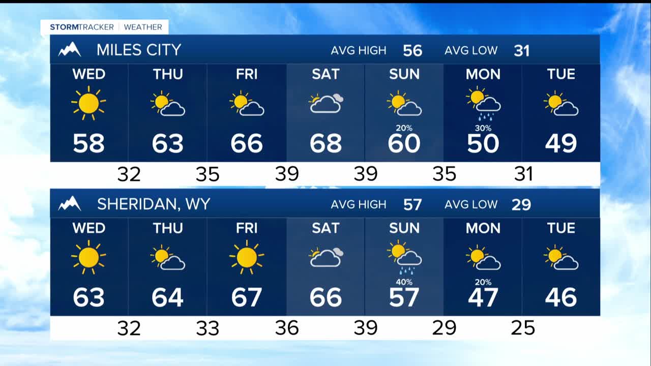
High Temperature Trend: For Wednesday mostly low 60s, gradually increasing to mid-to-upper 60s by Friday and Saturday. Near the Dakota border there is a 40% chance of highs above 70 on Saturday, but early next week, the region is cooling to upper 40s to low 50s by Tuesday.
