


BILLINGS — Snowfall will wind down from west to east through Thursday. The impacts on travel in eastern Montana will be significant with periods of heavy snow and poor visibility possible.
Billings could see additional light snow Wednesday night through Thursday morning. But heavier snow is expected in areas of eastern Montana sitting on the edge of a major winter storm that will impact North and South Dakota.
Accumulations of 2 to 4 inches seem within reach east of Billings through Thursday. Close to the North Dakota state line, place like Baker and Glendive could see 10 inches on the ground.
Once the current system moves into the Dakotas, conditions stay dry next week.
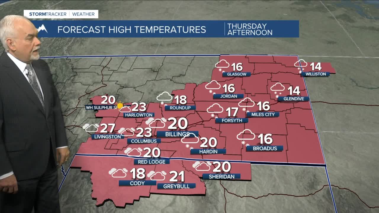
Temperatures will be in the single digits and low teens through Sunday morning. Highs are 15 to 25 degrees region-wide and then upper 20s to mid-30s well into next week.
