


BILLINGS — It’s a frigid start to Monday as a cold surface high stays in place, but we'll see some improvement this afternoon with highs reaching the mid-20s in the east and upper-30s in the west. Roads are very slick this morning, so take it slow and drive carefully.
Strong Chinook winds build late Monday into Tuesday, bringing gusty conditions to the western mountains and foothills. Expect gusts of 45 to 55 mph through the Livingston and Nye corridor, with 30 to 45 mph gusts from Harlowton to Big Timber. These winds could cause areas of blowing snow, especially where recent snow has fallen.
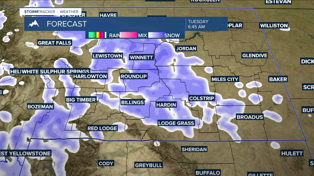
A split trough dropping in from the north will start affecting our western counties this evening. Snow arrives first in the west, then spreads across the rest of the area Tuesday through Wednesday morning. Tuesday afternoon could briefly warm enough for a rain/snow mix before turning back to all snow by the evening. Mountain areas could see four inches or more, with the highest peaks picking up even greater totals. The foothills could see a few inches, but most lower elevations will likely get less than half an inch. Icy spots are possible, so use caution if traveling.
The unsettled weather pattern continues Thursday into the weekend. Several quick-moving disturbances keep daily chances for rain and snow in the forecast, along with breezy to windy conditions—especially Friday into Saturday. There’s still some uncertainty with the exact timing, so check back for updates.
Highs reach the 30s to around 40° Tuesday, then drop again Wednesday with teens in the east and lower 30s in the west. Later in the week, temperatures range from the 20s and 30s to the 30s and 40s, depending on how each system lines up.
Miller Robson
Q2 Morning Meteorologist
miller.robson@ktvq.com
